PS Exam Preparation
Comprehensive preparation for the NCEES Principles and Practice of Surveying (PS) exam. 5 modules covering all 5 exam domains with 50 in-depth topics.
Module 1: Legal Principles
Module 2: Professional Survey Practices
Module 3: Standards & Specifications
Module 4: Business Practices
Module 5: Areas of Practice
Acquiescence & Boundary by Agreement
Learning Objectives
After completing this topic, you should be able to:
- Define acquiescence and distinguish it from adverse possession
- Explain the doctrine of practical location and its requirements
- Identify the elements of a valid boundary by agreement
- Describe how estoppel operates in boundary disputes
- Distinguish between mutual acquiescence and unilateral encroachment
- Recognize evidence of acquiescence in field conditions
- Apply these doctrines to determine whether an unwritten boundary has been established
Overview
Acquiescence, practical location, and boundary by agreement are related but distinct doctrines through which property owners can establish boundary lines that differ from the written deed description. Unlike adverse possession, these doctrines typically do not require hostility. Instead, they are grounded in the behavior of adjoining landowners who -- through their actions, silence, or mutual agreement -- establish a boundary line on the ground that becomes legally binding.
As Brown notes in Boundary Control and Legal Principles: unwritten title lines established by estoppel, agreement, or prescription are local in character and cannot be used to establish the lines of a written deed. They create a boundary between specific parcels, but they do not change the deed description itself.
Key Concepts
Acquiescence
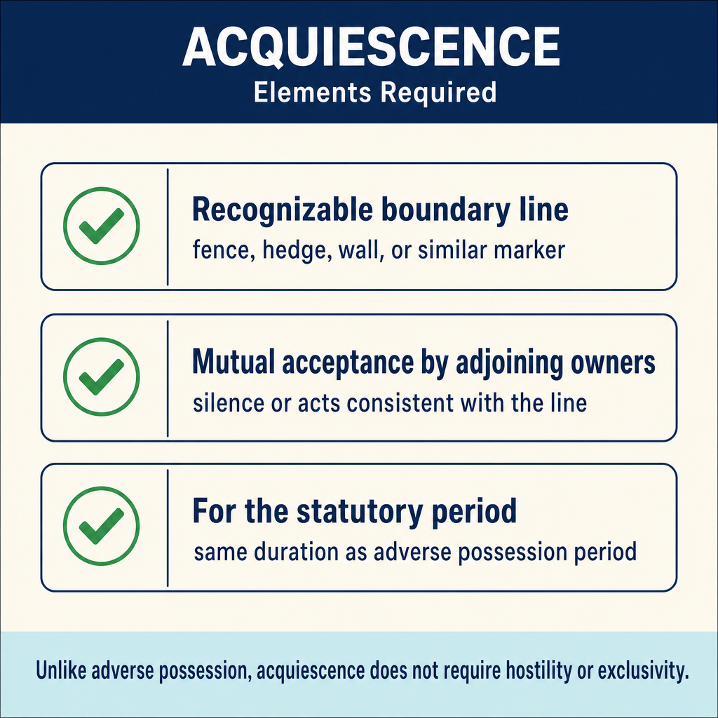
Acquiescence occurs when adjoining landowners treat a particular line as the boundary between their properties for a long period of time, typically at least as long as the statute of limitations for adverse possession. The line becomes the legal boundary regardless of where the "true" line (as described in the deeds) actually lies.
Key characteristics of acquiescence:
- Mutual mistake or uncertainty about the true boundary location
- Both parties treat the line as the boundary (not unilateral encroachment)
- The line is typically marked by a fence, hedge, wall, or other visible feature
- The recognition continues for a long period (often the statutory period)
- Hostility is NOT required -- this is the critical distinction from adverse possession
- Neither party needs to know the line is incorrect
Elements of acquiescence:
| Element | Description |
|---|---|
| Uncertainty or dispute | The true location of the boundary is uncertain or disputed |
| Recognizable line | A visible line exists on the ground (fence, hedge, etc.) |
| Mutual recognition | Both adjoining owners treat the line as the boundary |
| Duration | The recognition continues for the statutory period |
| Good faith | The parties act in good faith (no fraud or deception) |
Example: Two neighbors share a fence that was built 40 years ago. Both families have maintained their respective sides, mowed to the fence line, and treated the fence as the boundary. A modern survey reveals the fence is 3 feet onto one neighbor's property. Despite the survey showing the "true" line, the fence line may be the legal boundary by acquiescence because both parties treated it as such for decades.
Practical Location
Practical location (also called "location by practical construction") occurs when the parties to a deed, or their successors, locate the boundary on the ground and then act upon that location. Once practically located and acted upon, the boundary is fixed even if a more precise survey later shows it was incorrectly placed.
Requirements for practical location:
- Uncertainty about the boundary location
- An agreement (express or implied) on where the boundary is
- Acquiescence to the agreed-upon location for a significant period
- The parties or their successors act upon the location (build fences, improvements, etc.)
Practical location is particularly important in the context of original surveys. When an original surveyor placed a monument to mark a corner, and the adjoining owners accepted that monument and built their improvements accordingly, the monument's location becomes the boundary even if it was incorrectly placed relative to the theoretical position.
Boundary by Agreement
Boundary by agreement occurs when adjoining landowners, faced with uncertainty about the true boundary, expressly agree on a boundary line. This is the most straightforward of the unwritten boundary doctrines.
Requirements:
- Genuine uncertainty or dispute about the boundary location -- this is essential. If the boundary is clear, the parties cannot simply agree to move it (that would require a deed)
- Express or implied agreement to treat a specific line as the boundary
- The agreement must be acted upon -- the parties must conduct themselves in accordance with the agreed boundary
- The agreement must be fair and reasonable under the circumstances
Important limitation: A boundary by agreement cannot be used to convey land. If two owners simply agree to shift a boundary for convenience (with no genuine uncertainty), that agreement is really an attempted conveyance and must comply with the Statute of Frauds (written instrument, signed, etc.). The doctrine only applies when there is a bona fide uncertainty about where the true boundary lies.
Estoppel
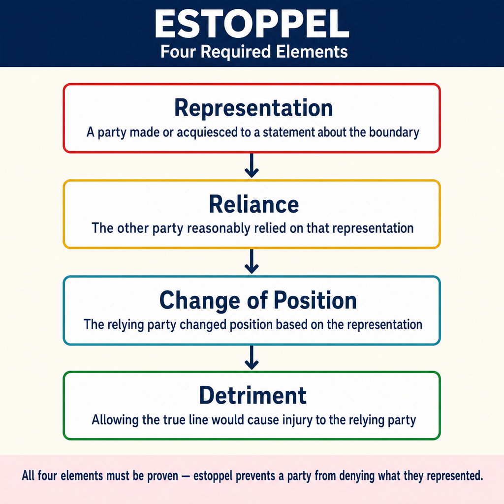
Estoppel prevents a party from asserting a right when their prior conduct would make it unjust to do so. In boundary contexts, estoppel operates when:
- One party makes a representation (by words or conduct) about the boundary location
- The other party relies on that representation
- The relying party changes position to their detriment (builds improvements, etc.)
- It would be unjust to allow the first party to now assert a different boundary
Example: Owner A tells Owner B that the boundary is at the fence line. Relying on this statement, Owner B builds a garage that extends to the fence. Owner A cannot later claim the boundary is actually 5 feet on the other side of the fence, because B relied on A's representation and built accordingly.
Types of estoppel relevant to boundary surveying:
| Type | Description |
|---|---|
| Equitable estoppel | Based on representations and detrimental reliance |
| Estoppel by deed | A grantor who conveys property is estopped from later denying the conveyance |
| Estoppel by silence | Failure to object when one has a duty to speak |
| Estoppel by conduct | Actions that induce reasonable reliance by another |
Distinguishing the Doctrines
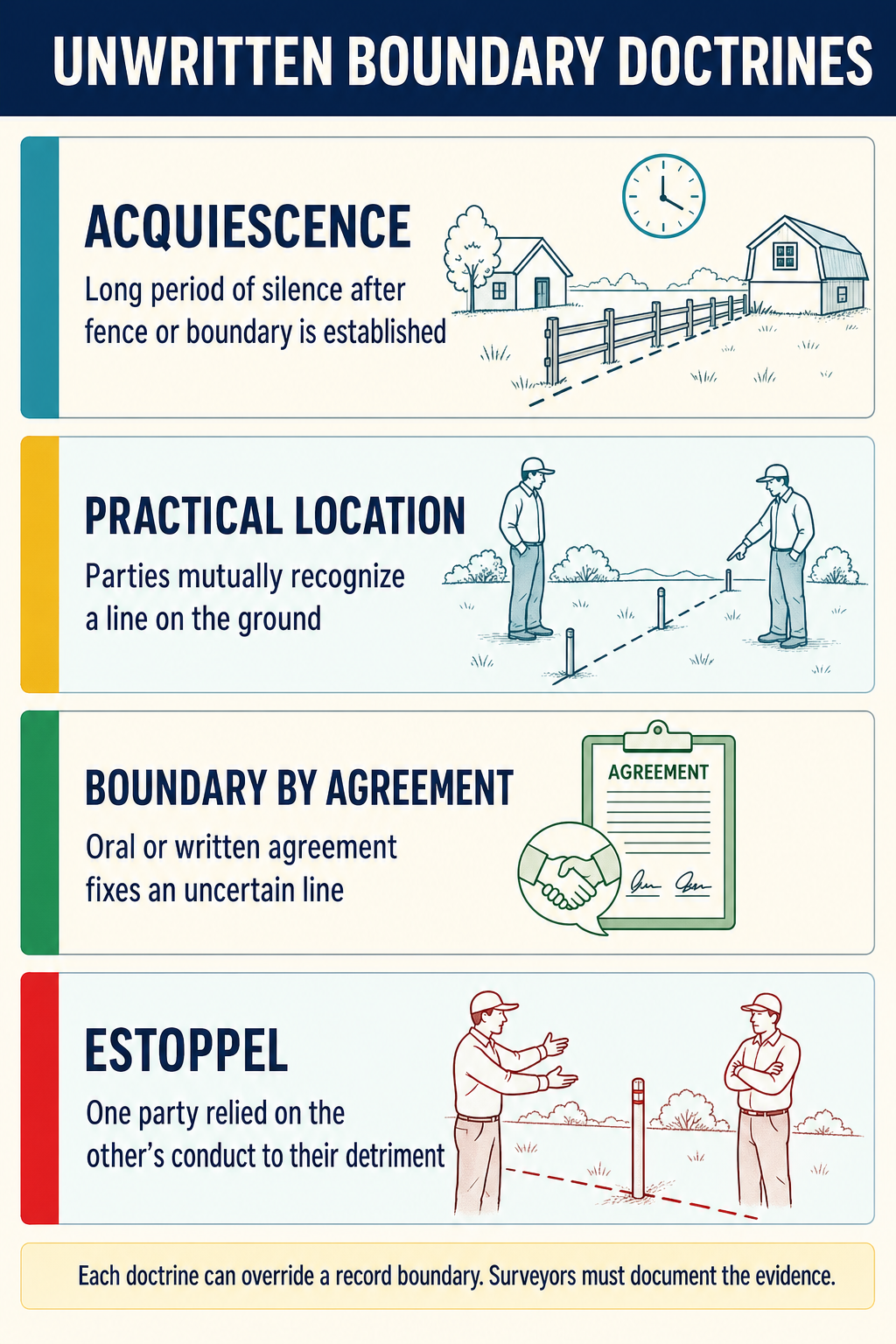
These related doctrines overlap but have important differences:
| Feature | Acquiescence | Practical Location | Agreement | Adverse Possession |
|---|---|---|---|---|
| Hostility required | No | No | No | Yes |
| Mutual conduct | Yes | Yes | Yes | No (unilateral) |
| Express agreement | Not required | Not required | Required | Not applicable |
| Uncertainty required | Yes | Yes | Yes | Not required |
| Statutory period | Usually required | Varies | Generally shorter | Required |
| Tax payment | No | No | No | Often required |
| Result | Fixed boundary | Fixed boundary | Fixed boundary | Transfer of title |
The Role of Fences
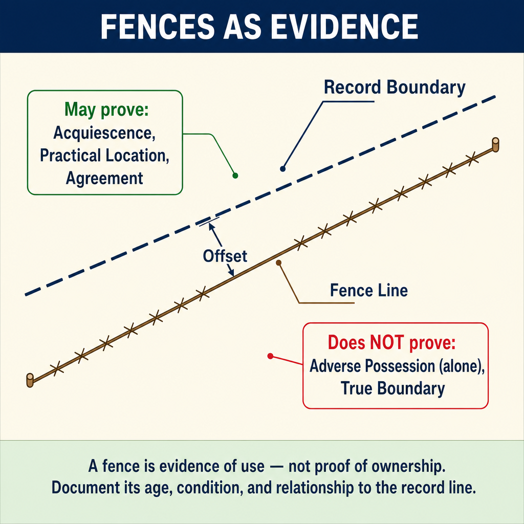
Fences play a central role in all of these doctrines. However, the surveyor must be careful not to assume that every old fence represents a legal boundary:
A fence may establish a legal boundary when:
- Both owners have treated it as the boundary for the statutory period
- Improvements were built in reliance on the fence location
- The parties expressly agreed the fence was the boundary
- The fence was placed by an original surveyor as a boundary marker
A fence does NOT establish a legal boundary when:
- It was built for convenience (livestock containment, privacy) with no intent to mark the boundary
- One party placed it knowing it was not on the line, and the other party was unaware
- It was placed with the permission of the adjoining owner as a permissive encroachment
- It has not been recognized for a sufficient period
Evidence the Surveyor Should Collect
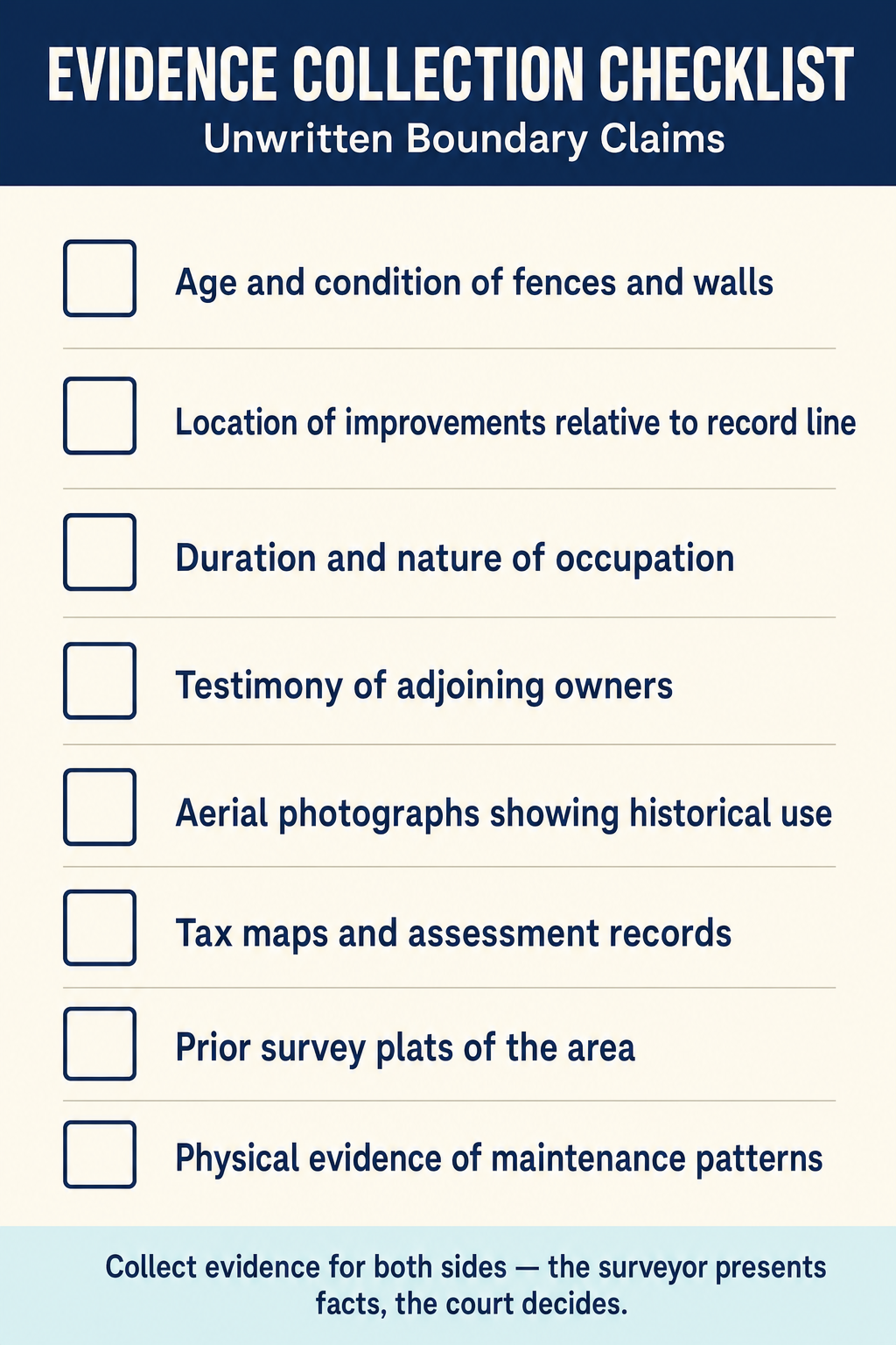
When investigating potential acquiescence or boundary agreement, the surveyor should document:
- Age and condition of fence lines, walls, hedges, and other potential boundary markers
- Maintenance patterns -- who maintains which side?
- Improvement locations -- are structures built to the fence line?
- Cultivation and landscaping patterns
- Testimony of owners and neighbors about the history of the fence or line
- Aerial photograph history showing the fence or occupation line over time
- Prior survey records -- do earlier surveys reference the fence or line?
- Tax assessment records -- do they correspond to the fenced area?
Practical Application for Surveyors
When the surveyor discovers that the occupation line (fence, improvements, etc.) differs from the record boundary:
- Show both lines on the survey plat -- the record boundary and the occupation line
- Note the discrepancy clearly in the survey notes
- Document the age and character of the occupation line
- Do not render a legal opinion on whether acquiescence has occurred -- that is for the courts
- Inform the client that unwritten rights may affect the boundary
- Recommend legal counsel when potential unwritten rights are significant
The surveyor's duty is to present the facts clearly so that the client and their attorney can make informed decisions.
Jurisdictional Variations
The requirements for establishing acquiescence and boundary by agreement vary by jurisdiction. The surveyor should be aware of general differences:
| Jurisdiction | Time Requirement | Key Distinctions |
|---|---|---|
| Most states | Typically the statute of limitations period (5-20 years) | Agreement requires genuine uncertainty; acquiescence requires long recognition |
| Some western states | May be as short as 5 years | Agreed boundary doctrine is well-established |
| Eastern states | Varies widely | Many follow the traditional common law requiring the full statutory period |
| Federal (PLSS) | N/A for government corners | Government survey corners cannot be relocated by private agreement |
Boundary by Parol Agreement vs. Deed
A critical distinction exists between a boundary agreement and a land transfer:
- A boundary agreement resolves an uncertainty about where an existing boundary lies. It does not transfer land from one party to another -- it clarifies what each party already owns.
- A land transfer (even of a small strip) must comply with the Statute of Frauds and requires a written deed, proper consideration, and recording.
- Courts scrutinize boundary agreements to ensure they are truly resolving uncertainty rather than disguising a land transfer.
The practical test: If two neighbors know exactly where the boundary is but want to move it for convenience, they need a deed. If two neighbors genuinely do not know where the boundary is and agree on a line, that is a valid boundary agreement.
Common Exam Scenarios
Scenario 1: The Old Fence Two properties share a fence built 50 years ago. A modern survey shows the fence is 4 feet onto Parcel B. Both owners have maintained their respective sides. This is classic acquiescence -- both parties treated the fence as the boundary for well beyond the statutory period.
Scenario 2: The Driveway Agreement Two neighbors disagree about which property a shared driveway is on. They agree to split the driveway at the center and each maintain their half. Ten years later, a survey shows the entire driveway is on one parcel. The boundary by agreement may fix the boundary at the centerline of the driveway because there was genuine uncertainty and the parties agreed and acted upon the agreement.
Scenario 3: The Garage Owner A tells Owner B the boundary is at the fence. Owner B builds a garage to the fence line. The true boundary is actually 3 feet on the other side of the fence. Owner A is estopped from claiming the true boundary because B relied on A's representation and built accordingly.
Scenario 4: Permission Defeats the Claim Owner A tells Owner B: "You can use that strip of land along the fence; I don't need it." Owner B uses the strip for 30 years. Because A gave permission, no acquiescence or prescriptive right can arise, regardless of the duration of use.
Common wrong path — treating every fence as a legal boundary. Fences are ubiquitous on boundary surveys, and not all fences are created equal. Before treating any fence as evidence of acquiescence, ask three questions: (1) Is there genuine uncertainty about the deed boundary? If the deed is clear and the parties know it, acquiescence doesn't arise. (2) Is the recognition mutual? A fence placed by one owner without the other's knowledge or acceptance is unilateral encroachment, not acquiescence. (3) Has it been recognized for the statutory period? A 3-year-old fence, regardless of how clearly it marks occupation, hasn't been in place long enough to invoke the doctrine. Exam questions bait this by describing a prominent old fence and asking whether it is the legal boundary — the correct answer almost always depends on facts beyond the fence's existence (deed clarity, mutual recognition, duration, absence of permission). A fence alone does not move a boundary.
Quick retrieval check — try before reading on.
▶Two neighbors share a hedge that has existed since 1985. The deeds on both sides are unambiguous, and both owners have assessor's tax maps showing the hedge is on Neighbor A's side, 6 ft from the record line. Neighbor A mows both sides of the hedge; Neighbor B maintains only the hedge branches that overhang their side. In 2026, Neighbor A wants to build a fence on the record line. Does acquiescence bar Neighbor A from doing so?
Probably not. Acquiescence requires genuine uncertainty about the boundary — and the fact that both parties have assessor's maps clearly showing the hedge is on A's side (6 ft from the record line) tends to negate uncertainty. If both owners knew all along that the hedge was not the boundary, the 41 years of the hedge's existence don't ripen into acquiescence. Additionally, the maintenance pattern (A mows both sides) suggests A treated the 6-ft strip as their own, not as mutual boundary recognition. Neighbor A is likely free to build the fence on the record line. That said: B could still argue acquiescence if B can produce evidence contradicting the "no uncertainty" conclusion (e.g., an old informal agreement, a prior survey that placed the boundary at the hedge). The surveyor's role is to document the facts — hedge location, age, maintenance patterns, assessor records — and let the parties' attorneys argue the legal conclusion.
Exam Tips
- Acquiescence does NOT require hostility -- this is the number one distinction from adverse possession
- Both parties must treat the line as the boundary for acquiescence; unilateral encroachment is not acquiescence
- Genuine uncertainty is required for boundary by agreement -- parties cannot simply agree to move a clear boundary
- Estoppel requires detrimental reliance -- the party must have changed their position based on the representation
- A fence that was placed by mutual agreement as the boundary line will likely be upheld even if later surveys show it is not on the "true" line
- Practical location by the original surveyor is especially strong evidence of boundary
- Permissive use (with the owner's consent) can never ripen into a prescriptive right or acquiescence
- The surveyor should show both the record boundary and the occupation line when they differ
- On the exam, look for scenarios where two neighbors both treat a fence as the boundary for a long time -- that is acquiescence
Related Test Topics
- Prescriptive Rights and Adverse Possession (Topic 1.3)
- Controlling Elements (Topic 1.5)
- Searching and Evaluating Evidence (Topic 1.1)
- Parol Evidence (Topic 1.2)
- Easement Rights (Topic 1.6)
Further Reading
Authoritative sources for deeper study
Brown's Boundary Control and Legal Principles (7th Ed.), chapters on evidence hierarchy and weighing of conflicting calls.
Evidence and Procedures for Boundary Location (Robillard, Wilson, & Brown, 7th Ed.) — Practical treatise on collecting, weighing, and applying boundary evidence.
Clark, A Treatise on the Law of Surveying and Boundaries — Long-standing legal reference on boundary disputes and surveyor liability.
Last updated: 2026-04-17