PS Exam Preparation
Comprehensive preparation for the NCEES Principles and Practice of Surveying (PS) exam. 5 modules covering all 5 exam domains with 50 in-depth topics.
Module 1: Legal Principles
Module 2: Professional Survey Practices
Module 3: Standards & Specifications
Module 4: Business Practices
Module 5: Areas of Practice
Communication of Field Procedures
Learning Objectives
After completing this topic, you should be able to:
- Describe effective communication protocols between survey crew members
- Explain the surveyor's communication responsibilities with clients
- Understand right of entry requirements and property owner notification practices
- Apply appropriate communication strategies when dealing with the public
- Identify conflict resolution approaches for field encounters
- Describe communication requirements with regulatory agencies
- Understand the role of communication in safety management
Overview
Professional surveying is fundamentally a communication discipline. The surveyor communicates through maps, reports, and legal descriptions, but equally important is the direct communication that occurs during every project: instructions to crew members, explanations to property owners, coordination with clients, and interaction with regulatory agencies. Effective communication prevents errors, reduces conflict, builds professional relationships, and protects the surveyor from liability.
Field communication presents unique challenges. Survey crews operate on other people's property, often without advance notice. They encounter curious neighbors, hostile landowners, aggressive animals, and confused members of the public. The surveyor's ability to handle these interactions professionally reflects on the entire profession.
Key Concepts
Communication Within the Survey Crew
Chain of Command
Effective field operations require clear lines of communication and responsibility:
| Role | Communication Responsibilities |
|---|---|
| Party chief | Receives project instructions from the surveyor in charge; directs crew activities; makes routine field decisions; communicates findings back to the office |
| Instrument operator | Communicates readings, observations, and anomalies to the party chief; confirms target identification |
| Rod person / chainperson | Communicates target setup, monument conditions, and observations at the point; alerts crew to safety concerns |
| Survey technician | Processes and reviews data; communicates discrepancies or questions to the party chief or project surveyor |
Pre-Project Briefing
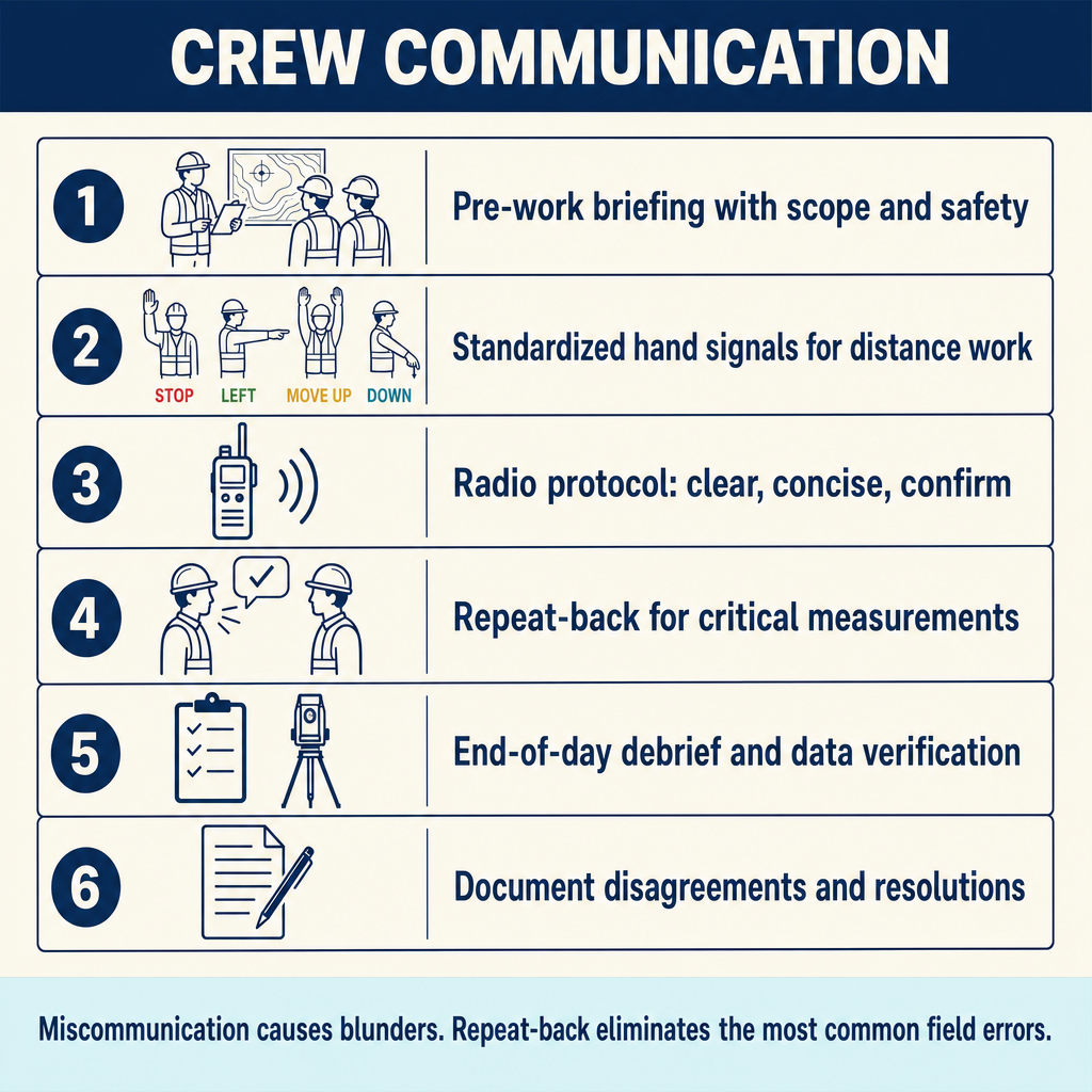
Before fieldwork begins, the party chief should brief the crew on:
| Topic | Content |
|---|---|
| Project scope | What is to be accomplished, boundaries of the project area |
| Special instructions | Specific procedures, accuracy requirements, unusual conditions |
| Property access | Right of entry status, known sensitive properties, contact protocol |
| Safety | Hazards identified, personal protective equipment required, emergency procedures |
| Coding and procedures | Feature codes, point numbering scheme, naming conventions |
| Schedule | Expected duration, break schedule, end-of-day procedures |
| Contact information | Phone numbers for project surveyor, client, utility locator, emergency services |
Field Signals and Protocols
Survey crews use standardized signals for efficient communication over distance:
| Signal | Meaning |
|---|---|
| Arm extended horizontally, waving | Move in the direction indicated |
| Both arms extended horizontally | Stop, hold position |
| Arm raised vertically | Point is set, ready for observation |
| Arm waving rapidly overhead | All right, understood |
| Arm extended, fist clenched | Plumb the rod (rod is not vertical) |
| Hand making circular motion | Turn instrument/rotate target |
| Hands raised and lowered repeatedly | Raise/lower the target |
In modern practice, two-way radios supplement or replace hand signals, but visual signals remain useful when radios fail, when noise prevents verbal communication, or when quick directional guidance is needed.
Real-Time Communication of Findings
Field personnel should immediately communicate to the party chief:
- Unexpected monument conditions -- found but not called for, not found where expected, damaged, conflicting evidence
- Access problems -- locked gates, hostile property owners, obstructed lines
- Discrepancies -- measurements that disagree significantly with record information
- Safety hazards -- unstable ground, traffic, overhead utilities, aggressive animals
- Equipment problems -- instrument malfunctions, low batteries, communication failures
Communication with Clients
Setting Expectations
Effective client communication begins before field work starts and continues through project delivery:
| Phase | Communication Topics |
|---|---|
| Engagement | Scope of work, limitations, deliverables, schedule, fee, what the survey will and will not determine |
| During field work | Progress updates, unexpected findings, scope changes, potential additional costs |
| Delivery | Explanation of results, boundary opinion, monument locations, recommendations |
| Post-delivery | Response to questions, clarification of findings, addressing concerns |
Explaining Survey Results
The surveyor must be able to explain technical findings in terms the client understands:
- Use clear, non-technical language when appropriate
- Use visual aids (the survey map) to illustrate boundary positions
- Explain discrepancies between the client's expectations and the survey findings
- Distinguish between facts (measurements, monuments found) and opinions (boundary position)
- Document verbal communications in writing (follow-up letter or email) to prevent misunderstandings
Managing Client Expectations
Common situations requiring careful communication:
| Situation | Communication Strategy |
|---|---|
| Boundary is not where the client expected | Present the evidence objectively; explain the analysis; avoid advocacy |
| Neighbor disputes with the survey results | Recommend the neighbor obtain their own survey; do not negotiate boundaries |
| Survey reveals encroachments | Document and report; do not provide legal advice; recommend attorney if needed |
| Additional work is needed | Explain why; provide cost estimate; obtain authorization before proceeding |
| Client pressures surveyor to move a boundary | Decline firmly; explain professional and legal obligations |
Communication with Property Owners and the Public
Right of Entry
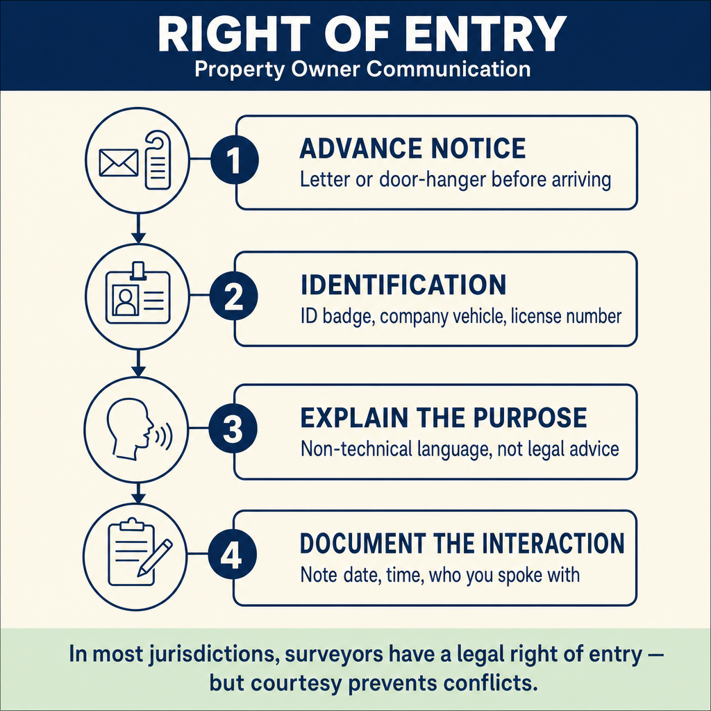
The surveyor's right of entry onto property varies by jurisdiction. Common principles include:
| Principle | Application |
|---|---|
| Statutory right of entry | Many states grant surveyors a right to enter property for survey purposes |
| Notification | Prior notice to the property owner is generally required where practicable |
| Reasonable access | The property owner must provide reasonable access without undue delay |
| Minimal impact | The surveyor should minimize disturbance to the property |
| Identification | Survey crews should carry identification and be prepared to explain their purpose |
| Damage responsibility | The surveyor is responsible for any damage caused during the survey |
Approaching Property Owners
When entering private property, survey crews should follow these practices:
- Attempt contact first -- knock on the door, call ahead when possible
- Identify yourself -- state your name, company, and purpose
- Show credentials -- carry business cards, company identification, or license information
- Explain the work -- briefly describe what you will be doing and why
- Estimate duration -- tell the owner approximately how long you will be on the property
- Ask about concerns -- inquire about pets, sensitive areas, or special considerations
- Leave contact information -- provide a card or note for owners who are not home
- Document the interaction -- note in field records who you spoke with and what was discussed
Handling Confrontations
Despite professional conduct, surveyors occasionally encounter hostile or uncooperative property owners:
| Situation | Response |
|---|---|
| Owner refuses access | Explain the legal right of entry calmly; offer to return later; do not force entry; report to project surveyor |
| Owner is verbally aggressive | Remain calm and professional; do not argue; leave if the situation escalates; document the encounter |
| Owner demands to know results | You may share general information about what you are doing but avoid discussing boundary positions or conclusions before the survey is complete |
| Owner claims the survey is wrong | Listen respectfully; note their concerns; explain that the survey is based on evidence and records; suggest they consult their own surveyor |
| Owner threatens physical harm | Leave immediately; document the threat; contact law enforcement if warranted; report to project surveyor |
Safety is always the priority. No measurement or monument is worth risking personal safety. If a situation becomes threatening, crews should leave and report.
Common wrong path — forcing entry onto refused property. Statutory right of entry allows surveyors to enter private property for boundary work — but this right is not absolute and does NOT mean the surveyor can force entry against an owner's active refusal. If an owner verbally refuses access, the surveyor must leave and report the refusal to the project surveyor. Force would escalate the situation, expose the surveyor to trespass or assault allegations, and damage the profession's reputation. The right course is to: (1) leave peacefully; (2) document the refusal with date, time, and circumstances; (3) report to the project surveyor who can pursue alternatives (written legal notification, court order, or surveying around the refused parcel). Exam questions sometimes describe a surveyor insisting on access despite refusal — the correct answer is always to withdraw and report, not to invoke statutory rights by force.
Quick retrieval check — try before reading on.
▶Your crew arrives at a property to perform boundary survey work. The owner comes out, identifies themselves, and states firmly "I don't care what the law says, you are not stepping on my property." The statutory right of entry clearly applies. What do you do?
Leave peacefully and report to the project surveyor. Even though the statutory right of entry grants you the legal authority to enter, invoking that right by force against an actively-refusing owner creates a hostile situation that is unsafe, unprofessional, and legally risky. Force might result in trespass allegations, confrontation, or personal injury — none of which serve the survey, the client, or the surveyor.
Instead: (1) calmly explain that you understand their concerns and will leave for now; (2) provide a business card with contact information; (3) note in field records the date, time, owner's name, and substance of the refusal; (4) report to the project surveyor immediately on returning to the vehicle. The project surveyor can then (a) send formal written notice citing the statutory right and requesting cooperation, (b) explore whether survey measurements from adjoining properties can avoid the refused parcel, (c) if necessary, seek a court order compelling access, or (d) advise the client that the survey may be limited in scope.
Exam question baiters sometimes include "invoke your statutory right and proceed anyway" as an answer choice — that's always wrong. The surveyor's personal safety and professional demeanor come first; legal remedies for obstruction are pursued through the office, not at the property line.
Notice to Property Owners
Some jurisdictions require formal notice before entering property. Even where not legally required, notice is a professional courtesy that reduces confrontations and demonstrates respect:
- Written notice (door hanger, letter, or posted notice) explaining the survey activity
- Include the surveyor's name, company, contact information, and purpose
- Provide dates and approximate times of the planned work
- Offer a contact number for questions or concerns
Communication with Agencies
Regulatory Coordination
Survey work frequently requires communication with government agencies:
| Agency | Communication Purpose |
|---|---|
| County surveyor | Map review, corner records, records research, filing coordination |
| County recorder | Document recording, map filing |
| Planning department | Zoning verification, subdivision requirements, permits |
| Public works | Encroachment permits, improvement standards, as-built requirements |
| Utility companies | Utility locates, easement information, conflict avoidance |
| Environmental agencies | Wetland delineation, habitat issues, mitigation requirements |
| State transportation | Right-of-way information, encroachment permits, survey coordination |
Utility Coordination
Before any subsurface work or staking near utilities, the surveyor should:
- Contact the one-call notification system (such as 811 in the United States) to request utility locates
- Contact individual utilities not covered by the one-call system
- Verify locate markings before beginning subsurface work
- Document all utility contacts, responses, and locate markings
- Protect existing utility marks during survey operations
Safety Communication
Tailgate Safety Meetings
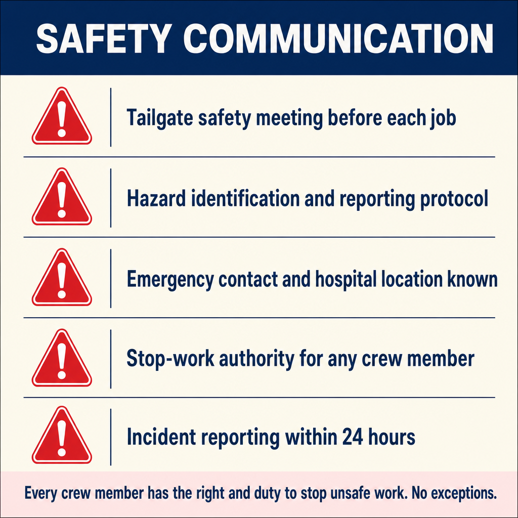
Brief safety discussions at the start of each work day (or when conditions change) should cover:
| Topic | Content |
|---|---|
| Site-specific hazards | Traffic, terrain, overhead utilities, excavations, wildlife |
| Personal protective equipment | Hard hat, safety vest, steel-toed boots, eye protection |
| Emergency procedures | Nearest hospital, emergency contacts, first aid supplies |
| Work zone safety | Traffic control, barricades, sign placement |
| Weather conditions | Heat stress, cold exposure, lightning, wind |
| Communication protocols | Radio channels, check-in schedule, emergency signals |
Incident Reporting
All safety incidents, near misses, and property damage should be:
- Reported immediately to the party chief and project surveyor
- Documented in field notes with details of what occurred
- Reported to the client and insurer as appropriate
- Used as lessons learned to prevent recurrence
Written Communication
Professional Correspondence
Written communication associated with survey projects should be:
| Characteristic | Application |
|---|---|
| Professional | Use proper grammar, spelling, and formatting |
| Precise | Use specific language; avoid ambiguity |
| Factual | State facts and observations; clearly identify opinions |
| Documented | Retain copies of all correspondence in project files |
| Timely | Respond to inquiries and submit documents promptly |
| Appropriate | Match the formality and detail to the audience and purpose |
Exam Tips
- Right of entry for surveyors is statutory in many jurisdictions but typically requires notification where practicable
- The surveyor should never provide legal advice to property owners regarding boundary disputes
- Safety is always the priority -- crews should leave if a situation becomes threatening
- Pre-project briefings ensure that all crew members understand the scope, procedures, and safety requirements
- Client communication should clearly distinguish between facts (measurements, evidence) and the surveyor's professional opinion
- Utility locates must be requested before any subsurface work
- All field confrontations and incidents should be documented in field notes
- Written communication in project files serves as evidence of professional conduct
- The surveyor should never adjust a boundary position based on client pressure
Related Test Topics
- Professional ethics and responsible charge (Module 1)
- Documentation and supervision (Topic 2.10)
- Right of entry law (Module 1)
- Field techniques and procedures (Topic 2.2)
- Client relations and contracts (Module 4)
- Safety management in surveying
Further Reading
Authoritative sources for deeper study
NCEES Model Rules of Professional Conduct (Aug 2025) — Model ethics, competence, and licensure rules adopted by most state boards.
Kavanagh, Surveying with Construction Applications (7th Ed.) — Combined surveying and construction-layout reference.
APWA Uniform Color Code — Standard utility-marking colors used in one-call locates.
Last updated: 2026-04-17