PS Exam Preparation
Comprehensive preparation for the NCEES Principles and Practice of Surveying (PS) exam. 5 modules covering all 5 exam domains with 50 in-depth topics.
Module 1: Legal Principles
Module 2: Professional Survey Practices
Module 3: Standards & Specifications
Module 4: Business Practices
Module 5: Areas of Practice
Searching for & Evaluating Evidence
Learning Objectives
After completing this topic, you should be able to:
- Identify and classify the four types of evidence used in boundary determination
- Distinguish between prima facie evidence and conclusive evidence
- Conduct a systematic records search for boundary retracement
- Evaluate the reliability and weight of different evidence categories
- Understand the chain of title and its significance to boundary location
- Apply evidence evaluation principles to real-world survey scenarios
Overview
Evidence evaluation is the core intellectual skill of boundary surveying. Before a surveyor sets foot in the field, a thorough records search and evidence evaluation must be completed. The surveyor must understand what types of evidence exist, how to find them, how to weigh them against one another, and how they combine to establish the location of boundaries on the ground.
A recurring theme in Evidence and Procedures for Boundary Location (Robillard & Wilson, 6th Ed.) is the duty to perform a thorough records search before fieldwork. Failure to do so can constitute negligence -- a survey based solely on measurement, without regard to the record evidence, may be technically precise but legally unsupportable.
Key Concepts
The Four Types of Evidence
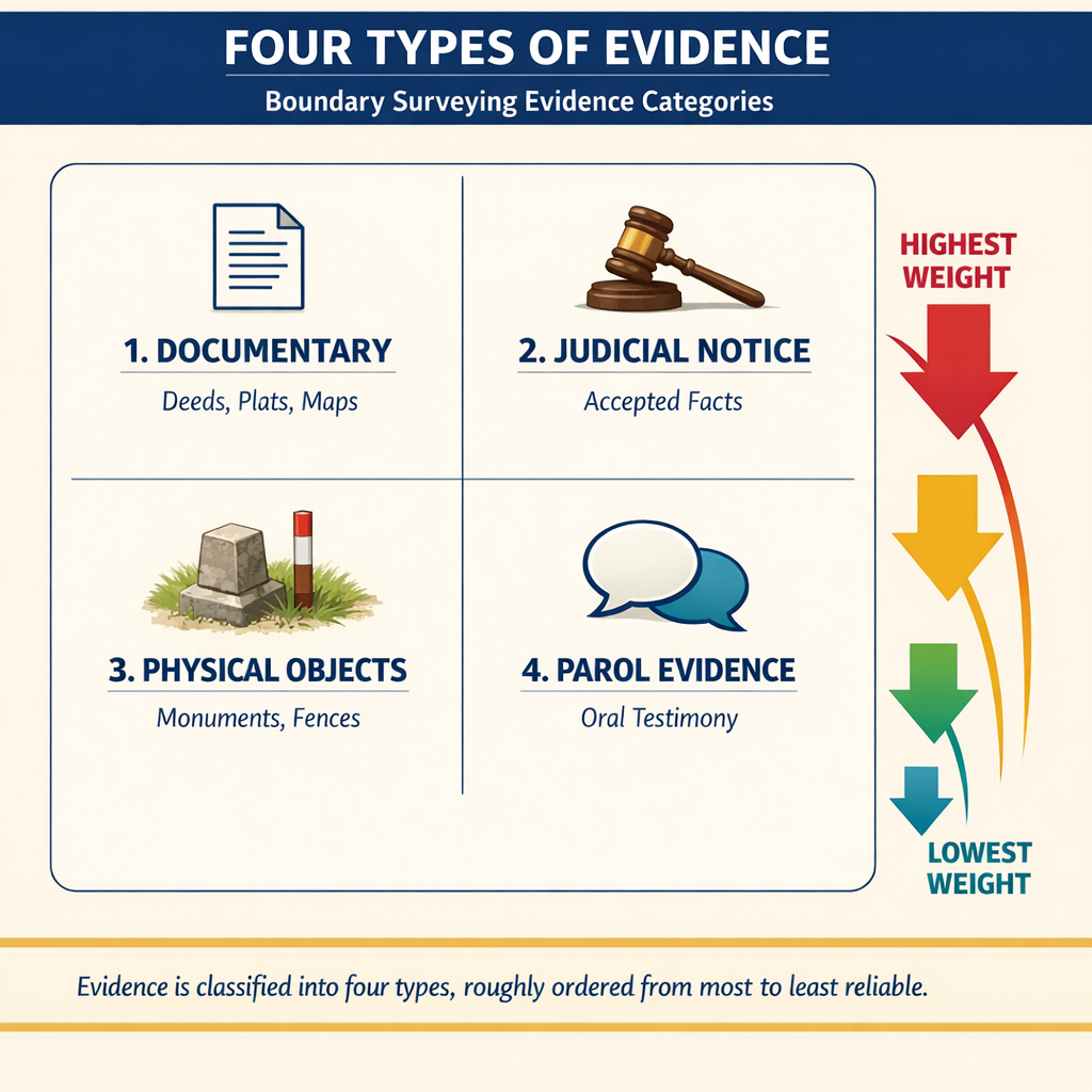
Evidence in boundary surveying falls into four fundamental categories. Each type carries different weight and serves different purposes in the boundary determination process.
1. Written Documents (Documentary Evidence)
Written documents form the primary foundation of most boundary determinations. These include:
| Document Type | Examples | Typical Source |
|---|---|---|
| Deeds | Grant deeds, warranty deeds, quitclaim deeds | County recorder |
| Plats and maps | Subdivision plats, records of survey, parcel maps | County recorder/surveyor |
| Court records | Judgments, quiet title actions, partition decrees | County clerk |
| Government records | GLO plats, BLM field notes, patents | BLM, National Archives |
| Title documents | Title reports, title insurance policies | Title companies |
| Historical maps | Assessor maps, USGS quads, aerial photographs | Various agencies |
| Prior surveys | Field notes, calculation sheets, records of survey | County surveyor, private files |
Documentary evidence is generally considered the most reliable form of evidence because it was created contemporaneously with the events it describes and is not subject to the frailties of human memory.
2. Judicial Notice
Judicial notice refers to facts so well established that courts accept them without formal proof. In surveying contexts, this includes:
- Geographic facts: The general location of rivers, mountains, and other natural features
- Government surveys: The existence and general accuracy of the PLSS
- Legal presumptions: That official surveys were properly conducted
- Common knowledge: Established facts about local geography and conditions
- Scientific principles: Accepted methods of measurement and calculation
Judicial notice serves as background knowledge that supports the interpretation of other evidence. A court will take judicial notice that magnetic declination changes over time, for example, without requiring expert testimony on the subject.
3. Physical Objects (Real Evidence)
Physical objects found on the ground provide direct evidence of boundary location. These include:
Natural monuments:
- Rivers, streams, lakes, and shorelines
- Ridgelines, bluffs, and escarpments
- Trees (bearing trees, witness trees, line trees)
- Rock outcrops and boulders
Artificial monuments:
- Iron pipes, rebar, and survey markers
- Fence lines and walls
- Stone mounds and pits
- Street improvements and curb lines
- Building corners and foundations
- Railroad rights-of-way
Evidence of occupation:
- Fence lines (even when not on the true line)
- Cultivation patterns
- Improvements and structures
- Roads and trails
The surveyor must carefully distinguish between monuments set to mark boundaries and objects that happen to be near boundaries. A fence built by an adjoining owner is evidence of where someone believed the boundary to be, but it is not necessarily evidence of the boundary itself.
4. Parol Evidence (Testimony)
Parol evidence consists of oral testimony and other evidence outside the written documents. This includes:
- Witnesses who observed original monuments being set
- Testimony about the location of now-destroyed monuments
- Statements by original parties about their intent
- Evidence explaining latent ambiguities in documents
- Testimony about local customs and practices
- Expert surveyor testimony about measurement methods
Parol evidence is generally considered the least reliable type of evidence because it depends on human memory, which fades and distorts over time. However, it may be the only evidence available when physical monuments have been destroyed or documents are ambiguous.
Prima Facie Evidence
Prima facie evidence is evidence that is sufficient to establish a fact unless rebutted by contrary evidence. In surveying:
- A recorded plat is prima facie evidence of the boundaries it depicts
- A government survey is prima facie evidence of the lines it establishes
- A deed description is prima facie evidence of the grantor's intent
- A monument found in place is prima facie evidence of the boundary location
The key characteristic of prima facie evidence is that it shifts the burden of proof. Once prima facie evidence of a boundary location is established, the opposing party must produce evidence to rebut it. If no rebutting evidence is produced, the prima facie evidence stands.
This does not mean prima facie evidence is conclusive. A surveyor who finds a monument in a position that contradicts reliable documentary evidence must weigh both forms of evidence and may conclude that the monument was incorrectly placed or has been disturbed.
Types of Notice
Recording systems work because the law charges parties with notice of certain facts whether or not they actually know them. Title and boundary questions frequently turn on which kind of notice applies:
- Actual (express) notice — knowledge or notice "given to a party directly, not arising from any inference, duty, or inquiry" (Black's Law Dictionary, 9th Ed.). A buyer who is handed a copy of an unrecorded easement agreement has actual notice of it. Direct notice is a form of actual notice — a fact "brought directly to a party's attention."
- Implied notice — notice "inferred from facts that a person had a means of knowing and that is thus imputed to that person" (Black's); actual notice of circumstances that, if properly followed up, would have led to knowledge of the fact in question. Visible wheel ruts crossing a parcel imply notice of a possible road easement, whether or not the buyer investigates.
- Constructive notice — "notice implied or imputed by law as the notice of a deed that has been recorded in a grantee–grantor index" (Brown's Boundary Control and Legal Principles, 7th Ed., Glossary). It arises "by presumption of law from the existence of facts and circumstances that a party had a duty to take notice of" (Black's). Recording a conveyance gives the entire world constructive notice of its contents — one cannot deny the matter contained in a constructive notice, even without ever having read the document.
- Judicial notice — facts a court accepts as true without requiring proof (covered under The Four Types of Evidence above).
The practical consequence for surveyors: a properly recorded document binds subsequent purchasers through constructive notice, which is why the systematic records search described below is a legal duty and not merely good practice.
Conducting a Systematic Records Search
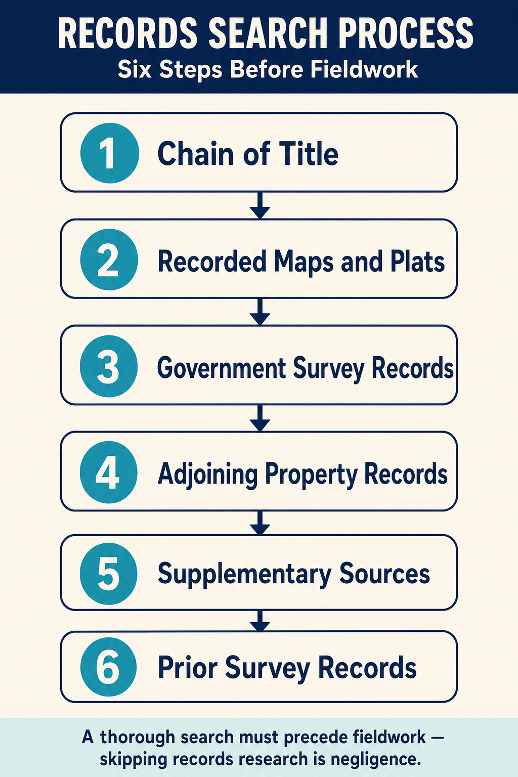
A thorough records search follows a systematic process. The surveyor should search these sources in roughly this order:
Step 1: Chain of Title
- Obtain a complete chain of title from the title company or county records
- Trace the property back to the original government patent or first conveyance
- Identify all deeds, plats, and encumbrances in the chain
Step 2: Recorded Maps and Plats
- Subdivision plats and final maps
- Records of survey (filed per state surveying practice act requirements)
- Corner records
- Parcel maps and lot line adjustments
- Assessor parcel maps
Step 3: Government Survey Records
- Original GLO survey plats and field notes
- Dependent resurvey plats and notes
- BLM cadastral survey records
- State land records (for state-patented lands)
Step 4: Adjoining Property Records
- Deeds and plats for all adjoining parcels
- Records of survey affecting adjacent boundaries
- Easement documents crossing or bordering the property
Step 5: Supplementary Sources
- Historical aerial photographs
- USGS topographic maps (multiple editions)
- County assessor records
- Court case files involving the property or neighbors
- Road records and right-of-way plans
- Utility easement records
Step 6: Prior Survey Records
- Contact the county surveyor for records of prior surveys
- Contact previous surveyors of record for field notes
- Review any calculation sheets or adjustment records
Common wrong path — skipping the records search "because the fieldwork is obvious." A seasoned crew can look at a parcel with clean occupation lines, existing monuments, and clear neighbors and conclude that the boundary is straightforward. The temptation is to bypass the records search and "just measure what's there." That is negligence. Evidence and Procedures explicitly treats failure to perform a thorough records search as a professional breach — a survey built on measurements alone, without regard to the documentary chain, may be mathematically precise but legally indefensible. The records search surfaces easements, prior surveys that placed corners differently, recorded but physically-absent monuments, chain-of-title defects, and senior/junior-rights context that no amount of fieldwork can reveal. Exam questions bait this trap by describing a "simple" survey and asking what step was inappropriate; if the surveyor went to the field without completing records research, the answer is the skipped research — not anything they did in the field.
Quick retrieval check — try before reading on.
▶A surveyor is asked to survey a 5-acre rural parcel. The client provides the most recent deed (2018) and says "the fences are good, just verify them." What records does the surveyor need, at minimum, before going to the field?
At minimum, the surveyor needs:
- Full chain of title back to the original patent or oldest deed in the chain — not just the most recent deed
- Prior recorded surveys (Records of Survey, corner records) affecting the parcel and adjoiners
- Adjoiner deeds for all parcels sharing a boundary (to identify senior/junior rights and check for gaps/overlaps)
- Original plat or survey that created the parcel
- Government records (GLO plat and field notes if PLSS; tax maps if pre-PLSS)
- Title report/commitment identifying easements, encumbrances, and exceptions
The 2018 deed alone is not enough. It's the starting point for tracing back, not the complete record. A client's assurance that "the fences are good" is irrelevant to the research obligation — the surveyor may ultimately conclude that the fences are good, but must reach that conclusion after evaluating the record evidence, not before. Performing fieldwork without the full record risks missing a senior-rights issue, an unrecorded easement, or a prior survey that places corners 5 ft from the fence line.
Evaluating Evidence Quality
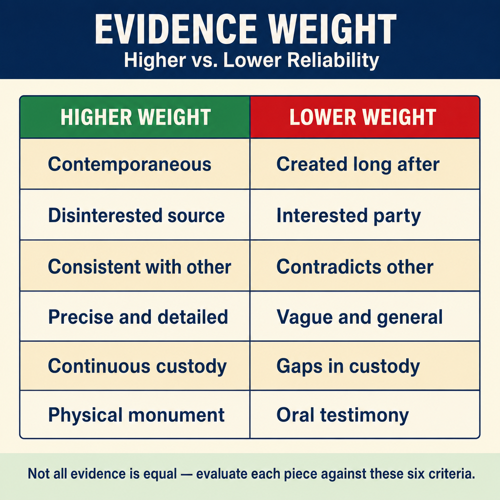
Not all evidence is equal. The surveyor must assess each piece of evidence against several criteria:
| Criterion | Higher Weight | Lower Weight |
|---|---|---|
| Age | Contemporaneous with the event | Created long after the event |
| Source | Disinterested party, official record | Interested party, informal record |
| Consistency | Agrees with other evidence | Contradicts other evidence |
| Specificity | Precise and detailed | Vague and general |
| Chain of custody | Continuously maintained | Gaps in custody, possible alteration |
| Type | Physical monument, official document | Oral testimony, informal notes |
The Weight of Conflicting Evidence
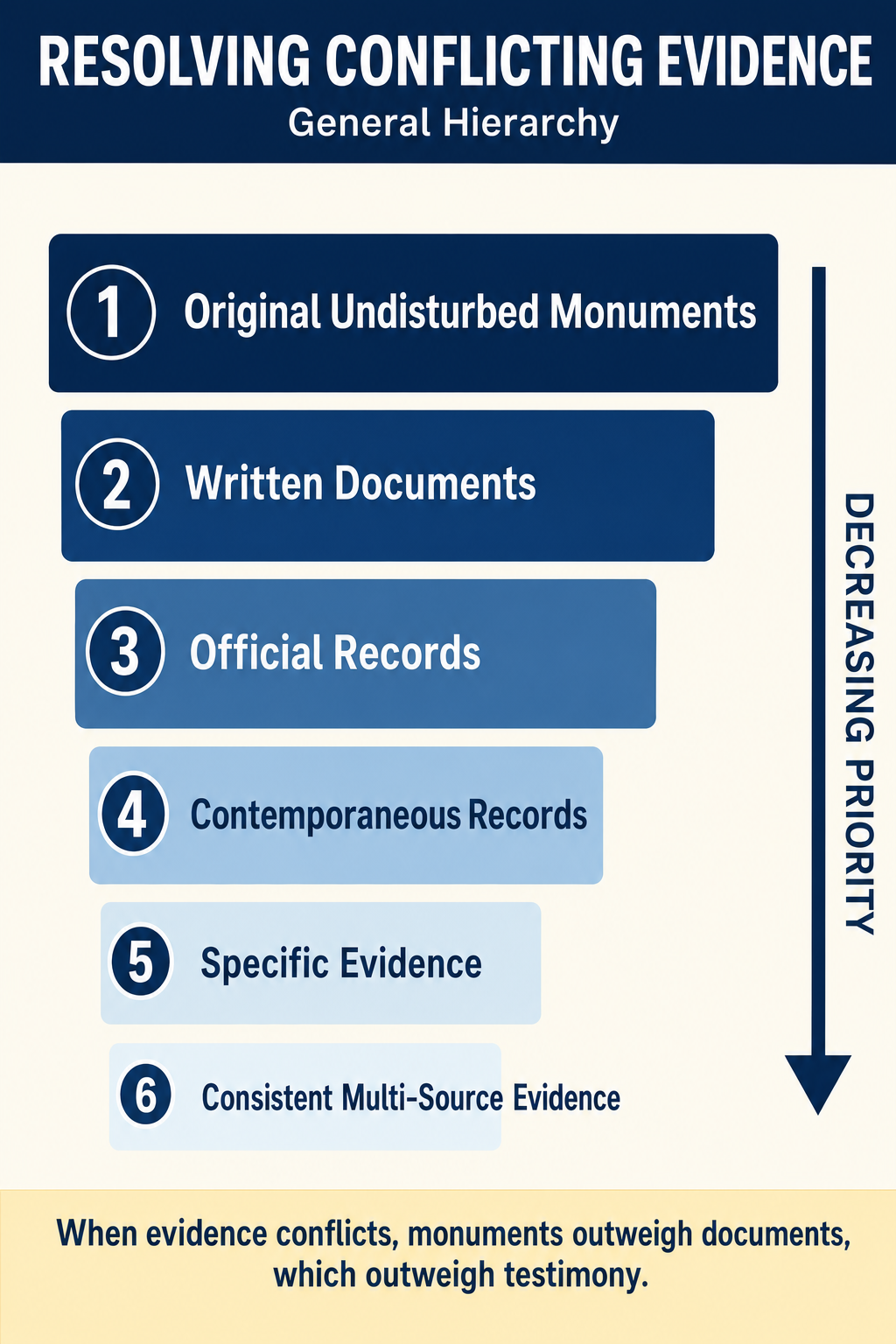
When evidence conflicts -- and it frequently does -- the surveyor must apply legal principles to resolve the conflict. The general hierarchy is:
- Original, undisturbed monuments outweigh everything else
- Written documents outweigh oral testimony (with exceptions for latent ambiguity)
- Official records outweigh private records
- Contemporaneous records outweigh later records
- Specific evidence outweighs general evidence
- Consistent evidence from multiple sources outweighs isolated contradictory evidence
The surveyor must document the reasoning behind each evidentiary decision. When a survey is challenged in court, the surveyor will need to explain why certain evidence was given more weight than other evidence.
Common Pitfalls in Evidence Evaluation
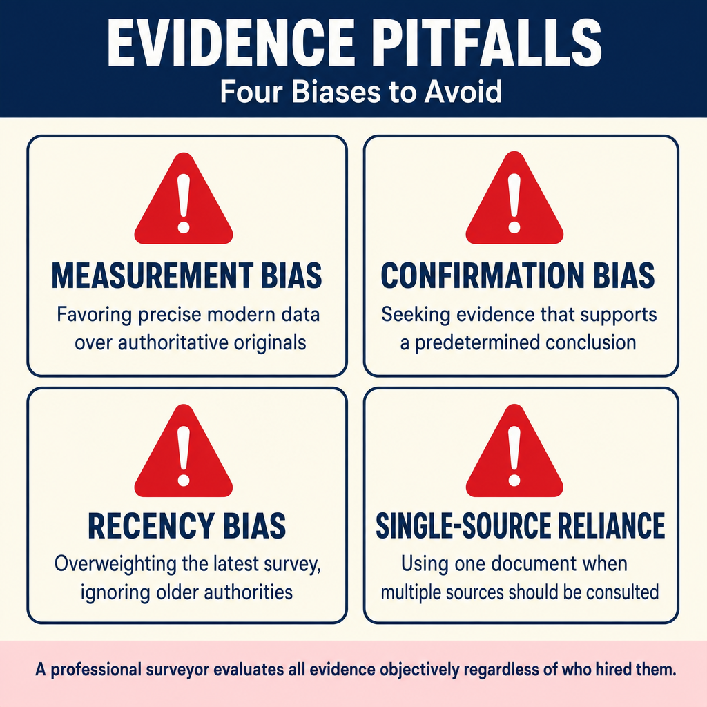
Measurement bias: Giving excessive weight to precise modern measurements while ignoring less precise but more authoritative original evidence. The original surveyor's intent, as evidenced by monuments and field notes, controls over modern remeasurement.
Confirmation bias: Searching for evidence that supports a predetermined conclusion while ignoring contradictory evidence. The surveyor must objectively evaluate all evidence regardless of which party engaged the surveyor.
Recency bias: Giving excessive weight to the most recent survey while ignoring older but potentially more authoritative surveys closer in time to the original.
Single-source reliance: Relying on a single piece of evidence when multiple sources should be consulted. A thorough search reduces the risk of error from any single source.
Exam Tips
- The four types of evidence (documentary, judicial notice, real, parol) are frequently tested -- know examples of each
- Prima facie evidence can be rebutted; it is not conclusive
- A monument found in place is prima facie evidence of the boundary, but it must be evaluated in context
- The chain of title search should go back to the original patent or first conveyance
- Physical evidence on the ground (monuments, fences, occupation lines) must be evaluated alongside documentary evidence
- Remember that the surveyor's role is to evaluate evidence, not simply measure -- this distinction is central to the PS exam
Related Test Topics
- Parol Evidence (Topic 1.2)
- Controlling Elements (Topic 1.5)
- Legal Descriptions (Topic 1.9)
- PLSS Perpetuation (Topic 1.10)
- Deed and plat interpretation
- Chain of title analysis
Further Reading
Authoritative sources for deeper study
Evidence and Procedures for Boundary Location (Robillard, Wilson, & Brown, 7th Ed.) — Practical treatise on collecting, weighing, and applying boundary evidence.
Brown's Boundary Control and Legal Principles (7th Ed.), chapters on evidence hierarchy and weighing of conflicting calls.
Clark, A Treatise on the Law of Surveying and Boundaries — Long-standing legal reference on boundary disputes and surveyor liability.
Last updated: 2026-04-17