PS Exam Preparation
Comprehensive preparation for the NCEES Principles and Practice of Surveying (PS) exam. 5 modules covering all 5 exam domains with 50 in-depth topics.
Module 1: Legal Principles
Module 2: Professional Survey Practices
Module 3: Standards & Specifications
Module 4: Business Practices
Module 5: Areas of Practice
BLM Manual of Surveying Instructions
Learning Objectives
After completing this topic, you should be able to:
- Distinguish between original surveys and dependent resurveys
- Identify the four categories of PLSS corners and their restoration rules
- Apply single and double proportionate measurement methods
- Explain the legal authority and purpose of the BLM Manual
- Describe the procedures for subdividing sections
- Understand when an independent resurvey is appropriate vs. a dependent resurvey
Overview
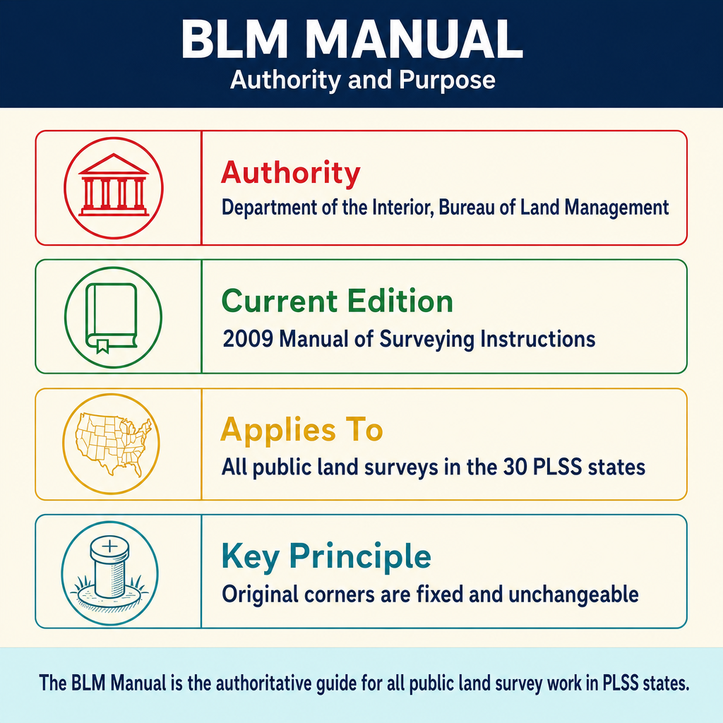
The Bureau of Land Management (BLM) Manual of Surveying Instructions (2009 edition) is the authoritative reference governing the survey and resurvey of public lands in the United States under the Public Land Survey System (PLSS). While originally published to guide federal cadastral surveyors, its principles have been adopted by courts and practitioners nationwide as the standard for restoring PLSS corners and interpreting the rectangular survey system.
For the PS exam, this is where PLSS theory meets practice. You must understand the hierarchy of corner evidence, the difference between original and dependent resurveys, and the proportionate measurement methods used to restore lost corners.
Key Concepts
Authority and Purpose of the BLM Manual
The BLM Manual derives its authority from federal statutes governing the disposal and survey of public domain lands. The manual serves three primary purposes:
- Establishing procedures for the original survey of unsurveyed federal lands
- Defining methods for the resurvey and restoration of previously surveyed lands
- Providing guidance for the subdivision of sections into aliquot parts
The manual is not a law itself, but it carries the weight of regulatory authority for federal surveys. State courts have widely adopted its principles for interpreting PLSS boundaries even on private land.
Original Surveys vs. Resurveys
This distinction is fundamental to the PS exam.
Original Survey: The first official government survey of a township. An original survey creates boundaries -- it is a creative act. The monuments set, distances measured, and plat filed in the original survey establish the legal boundaries of sections and townships. Even if measurements were inaccurate, the original survey controls because it was the act that created the property.
Dependent Resurvey: A resurvey that reestablishes the original survey boundaries based on all available evidence of the original corner positions. A dependent resurvey follows the footsteps of the original surveyor and restores corners to their original positions (or as close as evidence allows). It does not create new boundaries.
Independent Resurvey: A completely new survey that supersedes the original survey. Independent resurveys are rare and require specific Congressional authorization because they can alter property boundaries. They are used only when the original survey is so defective that restoration is impossible.
| Feature | Original Survey | Dependent Resurvey | Independent Resurvey |
|---|---|---|---|
| Purpose | Create new boundaries | Restore original boundaries | Replace original survey |
| Authority | BLM directive | BLM directive | Congressional authorization |
| Effect on boundaries | Establishes them | Reestablishes them | May alter them |
| Frequency | Historical (mostly complete) | Common | Rare |
Corner Categories
The BLM Manual classifies corners into four categories based on the quality of evidence available. The classification determines the restoration procedure.
Existent Corner: A corner whose position can be identified by verifying the evidence of the monument or its accessories (bearing trees, pits, mounds) as described in the original field notes. An existent corner is the best evidence and is accepted without question.
Obliterated Corner: A corner at whose point there are no remaining traces of the original monument or its accessories, but whose position can be recovered beyond reasonable doubt by the testimony of witnesses or by some acceptable evidence (written or physical). The key distinction: the position is known, but the physical monument is gone.
Lost Corner: A corner whose position cannot be determined beyond reasonable doubt, either from traces of the original marks or from acceptable evidence. A lost corner has no recoverable physical evidence and no reliable testimony. Lost corners must be restored by proportionate measurement.
Closing Corner: A corner established where a survey line intersects a previously established boundary. Closing corners are set at the actual point of intersection. They are not subject to proportionate measurement because their position is defined by the intersection itself.
| Corner Type | Monument Present? | Position Known? | Restoration Method |
|---|---|---|---|
| Existent | Yes (or accessories) | Yes | Accept as found |
| Obliterated | No | Yes (from evidence) | Restore from evidence |
| Lost | No | No | Proportionate measurement |
| Closing | Varies | Defined by intersection | Not proportioned |
Proportionate Measurement
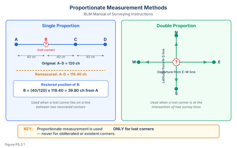
Proportionate measurement is the BLM-prescribed method for restoring lost corners. The principle is that any error in the original survey is distributed proportionally among all intervals along the line. This ensures that no single property owner bears the entire burden of original survey error.
Single Proportion: Used when the lost corner lies on a line between two existent or recovered corners. The lost corner is placed at a position that gives the same proportional distance between the controlling corners as shown on the original plat.
For example, if the original plat shows four quarter-mile intervals along a section line but the total remeasured distance is 5,310 feet instead of 5,280 feet, each interval is proportionally adjusted to absorb its share of the 30-foot excess.
Double Proportion: Used when the lost corner is a standard township or section corner that lies at the intersection of two survey lines. The position is determined by proportioning along both the meridional (north-south) and latitudinal (east-west) lines independently, then combining the results to establish a single position.
Double proportion applies to:
- Interior section corners (controlled by lines in two directions)
- Quarter-section corners on lines that control in both directions
Single proportion applies to:
- Quarter-section corners on established lines
- Standard corners on a single line
- Any corner controlled in only one direction
Key Rule: Proportionate measurement is used ONLY for lost corners. If any acceptable evidence exists to recover the corner position, proportionate measurement is not appropriate -- the corner is obliterated, not lost.
Common wrong path — proportioning an obliterated corner. The fastest way to generate a wrong answer on a PS PLSS question is to blur the line between lost and obliterated. If local residents remember where the stone was, or a bearing tree stump survives in the field notes' bearing and distance, the corner is obliterated — you recover its position from that evidence, not from proportioning. Proportioning is a last resort, used only when no recoverable evidence exists. Exam questions plant the trap by describing an "old iron post that was removed" or "plowed-under stone whose position the landowner still knows" — in those scenarios, the corner is obliterated and must be restored from evidence, not by splitting excess/deficiency across the interval. The BLM Manual is explicit: if acceptable evidence exists, proportionate measurement is inappropriate.
Quick retrieval check — try before reading on.
▶A section line runs 1 mile between existent section corners. The quarter-section corner at the midpoint is lost. The original plat records the line as 80.00 chains (5,280.00 ft). Your remeasurement between the existent end corners shows 5,295.00 ft. Where does the lost quarter corner go?
Single proportion applies (lost corner on a line controlled by two existent corners). The quarter corner's record position is at 40.00 chains (2,640.00 ft) from the south existent corner, which is exactly half the record distance. Placed proportionally in the measured distance: 2,647.50 ft from the south existent corner — exactly half of the 5,295 ft measured distance. The 15-ft excess is split evenly between the two half-mile intervals (7.5 ft each). This is the simplest single-proportion case: two existent corners, one lost corner at the known record proportion of the interval.
Subdivision of Sections
The BLM Manual prescribes specific methods for subdividing sections into aliquot parts (halves, quarters, quarter-quarters).
Standard Section (Interior Section):
- Quarter-section corners are at the midpoints of section boundaries
- The center of the section is at the intersection of lines connecting opposite quarter-section corners
- Quarter-quarter corners are at the midpoints of quarter-section boundaries
Sections Along the North and West Boundaries of a Township: These sections absorb all excess or deficiency from the original survey. The north and west tiers of lots are fractional. When subdividing:
- Standard quarter-section corners are placed at 40 chains from the south and east section corners
- All excess or deficiency falls in the north and west half-mile
- Fractional lots are created along the north and west boundaries
Irregular Sections: Sections with meandered water boundaries, mineral claims, or other irregular features require special subdivision procedures described in the manual.
Order of Procedure for Dependent Resurvey
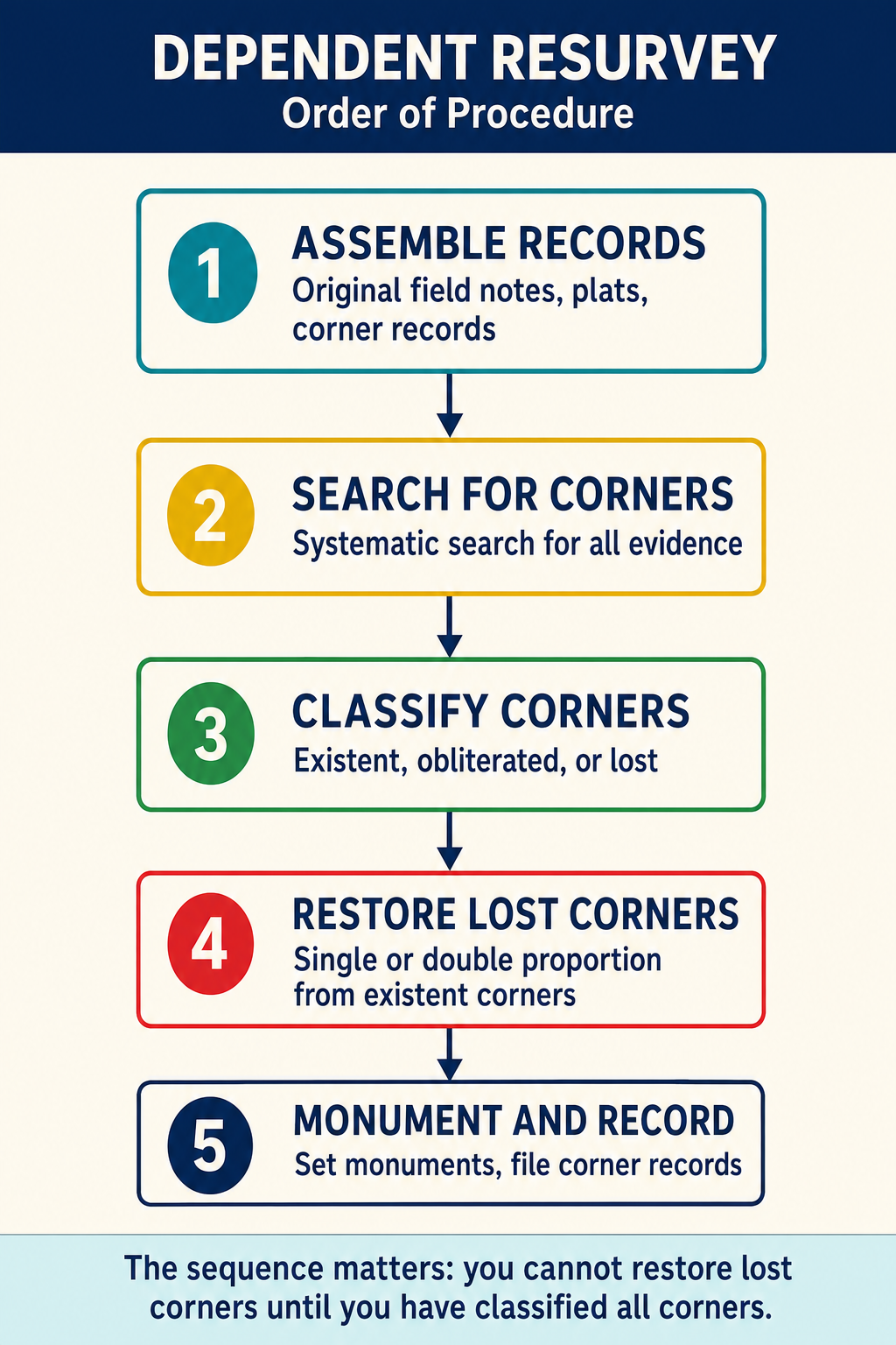
The BLM Manual prescribes a systematic approach:
- Research: Examine original field notes, plats, and all subsequent survey records
- Identify existent corners: Begin with corners that can be positively identified
- Recover obliterated corners: Use testimony, written records, and physical evidence
- Restore lost corners: Apply proportionate measurement only after exhausting all evidence
- Subdivide sections: Follow prescribed methods for creating aliquot part boundaries
- Monument and record: Set durable monuments and prepare complete records
Evidence Evaluation for Corner Recovery
The BLM Manual establishes a hierarchy for evaluating corner evidence:
- Original monument in place -- highest priority
- Bearing trees or other accessories as described in field notes
- Witness testimony from reliable sources who observed the original monument
- Fence lines, occupation lines, and improvements that relate to the original corner
- Proportionate measurement -- last resort for truly lost corners
The surveyor must exercise professional judgment in evaluating evidence. A single bearing tree that matches the original field notes (species, bearing, distance) is compelling evidence. Multiple lines of evidence pointing to the same location provide high confidence.
Exam Tips
- The PS exam frequently tests the distinction between lost and obliterated corners -- remember that the difference is whether the position can be recovered, not whether the monument exists
- Know when to use single vs. double proportion: single proportion is along one line; double proportion is at the intersection of two lines
- Excess and deficiency in sections falls to the north and west boundaries of the township -- this is a classic exam question
- An original survey, even if inaccurate, controls over a more accurate resurvey because the original survey created the boundaries
- Independent resurveys require Congressional authorization -- if the exam asks about correcting a grossly defective original survey, this is the answer
- Closing corners are NOT proportioned -- they are defined by the intersection of survey lines
- The 2009 BLM Manual is the current edition and the one tested on the PS exam
- When a question describes a corner where "no trace of the original monument remains but local residents remember its location," the corner is obliterated (not lost) because the position can be recovered
Related Test Topics
- Controlling elements and evidence hierarchy (Module 1, Topic 1.5)
- PLSS perpetuation and corner evidence (Module 1, Topic 1.10)
- Sequential and simultaneous conveyances in PLSS context (Module 1, Topic 1.8)
- Legal descriptions referencing PLSS (Module 1, Topic 1.9)
- Professional liability in boundary determination (Module 2)
Further Reading
Authoritative sources for deeper study
BLM Manual of Surveying Instructions (2009) — Federal authority on PLSS surveys, corner restoration, and rectangular system.
BLM Manual of Surveying Instructions (2009), Ch. III — Standards for execution of public-land surveys.
BLM Manual of Surveying Instructions (2009), Ch. V — Restoration of lost and obliterated corners.
BLM Manual of Surveying Instructions (2009), Ch. VII — Subdivision of sections.
Last updated: 2026-04-17