FS Exam Preparation
Comprehensive preparation for the Fundamentals of Surveying (FS) exam. 7 modules covering all 7 exam domains with 60 in-depth topics.
Module 1: Surveying Processes & Methods
Module 2: Mapping Processes & Methods
Module 3: Boundary Law & Real Property
Module 4: Surveying Principles & Geodesy
Module 5: Survey Computations
Module 6: Business Concepts
Controlling Elements & Evidence
Learning Objectives
After completing this topic, you should be able to:
- State the hierarchy of controlling elements from memory
- Apply the hierarchy to resolve conflicting deed calls
- Distinguish between types of monuments and their relative weight
- Explain the measurement sub-hierarchy
- Identify when the hierarchy may be overridden
- Evaluate boundary evidence from field and record sources
Overview
When elements of a property description conflict -- and they almost always do to some degree -- the surveyor must know which elements take priority. The hierarchy of controlling elements provides the framework for resolving these conflicts. This hierarchy, developed through centuries of common law, is the single most important legal concept in boundary surveying.
The hierarchy is commonly remembered by the mnemonic SICMoMe: Senior rights, Intent, Call for a survey, Monuments, Measurements.
Key Concepts
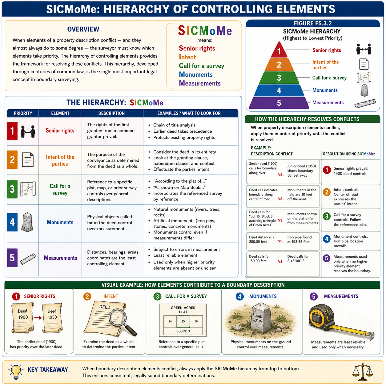
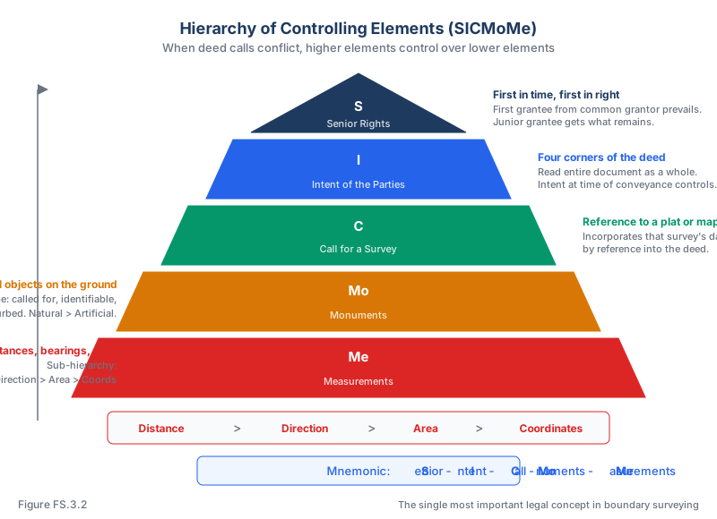
The Hierarchy: SICMoMe
The controlling elements, in order of priority from highest to lowest (Brown's Boundary Control and Legal Principles, 7th Ed., Ch. 11):
| Priority | Element | Description |
|---|---|---|
| 1 | Senior rights | The rights of the first grantee from a common grantor prevail |
| 2 | Intent of the parties | The purpose of the conveyance as determined from the deed as a whole |
| 3 | Call for a survey | Reference to a specific plat, map, or prior survey |
| 4 | Monuments | Physical objects called for in the deed |
| 5 | Measurements | Distances, bearings, areas, coordinates |
Senior Rights
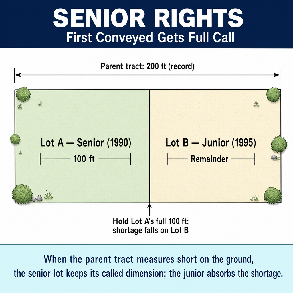
The first conveyance from a common grantor has priority. The senior grantee gets exactly what was described; the junior grantee gets what remains.
Key principles:
- First in time, first in right
- The grantor cannot convey what has already been conveyed
- Senior rights apply to sequential conveyances from the same grantor
Intent of the Parties
Intent is determined from the four corners of the deed -- the entire document read as a whole, not isolated phrases.
- When language is clear, the deed speaks for itself
- When language is ambiguous, extrinsic evidence may be considered
- Intent at the time of conveyance controls, not later intentions
Monuments
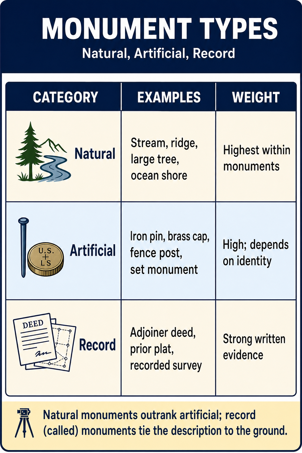
Monuments are physical objects called for in the deed. They rank above measurements because they are tangible references the parties could see and agree upon.
Three requirements for a controlling monument:
- Called for in the deed or plat
- Identifiable as the one called for
- Undisturbed from its original position
Monument hierarchy:
- Natural monuments (streams, ridges, trees) generally control over artificial monuments (iron pipes, concrete, fences)
- Natural monuments are more permanent and less susceptible to human disturbance
Measurements Sub-Hierarchy
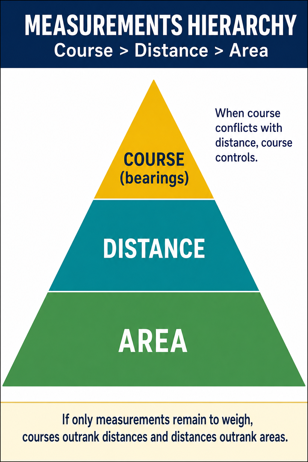
Within measurements, the ranking of bearing vs. distance is jurisdiction- and fact-specific (per Brown's §11.29, "the courts have had diverse opinions as to which should yield," and in metes-and-bounds descriptions with no called-for monument "both bearing and distance are essential for the determination of a line, and neither need yield to the other"). Area and coordinates rank below both:
| Rank | Type | Notes |
|---|---|---|
| Tied at top | Bearing (direction) and Distance | Courts split. Some jurisdictions historically rank bearing higher (compass-era reasoning); others rank distance higher (modern EDM-era reasoning). Read the controlling case law for the jurisdiction of the survey. |
| Below both | Area | Computed from bearing and distance; circular dependency makes area unreliable as an independent call. |
| Lowest | Coordinates | Most recent addition; depends on underlying network and projection. |
Types of Boundary Evidence
Physical evidence (found in the field):
- Monuments (iron pipes, rebar, stones, brass caps)
- Natural features (streams, trees, rock outcrops)
- Occupation evidence (fences, walls, cultivation lines, buildings)
- Accessories (bearing trees, reference points)
Record evidence (found in documents):
- Deeds with legal descriptions
- Recorded plats and maps
- Original survey field notes
- Prior survey records
- Aerial photographs (historical and current)
- Records of Survey, and Corner Records (Corner Records are required in California and certain other western states; not universal)
Testimonial evidence:
- Statements from landowners, neighbors, and prior surveyors about boundary locations, monuments, and historical use
Evaluating Evidence
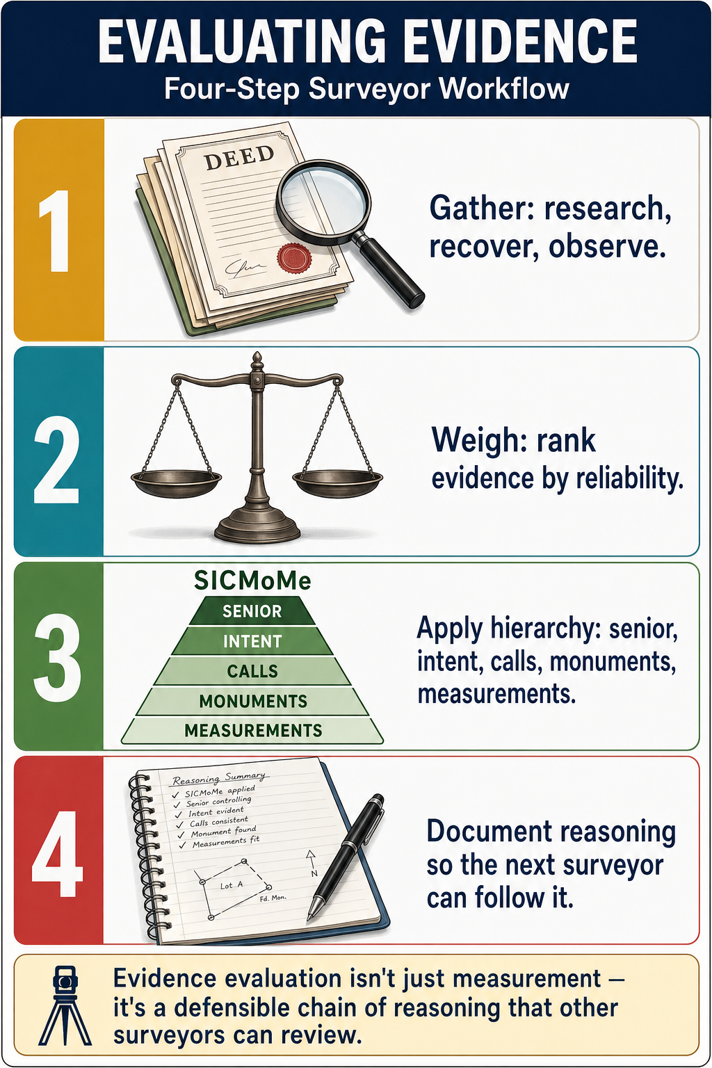
The surveyor must weigh all available evidence:
- Best evidence is a monument that is called for, identifiable, and undisturbed
- Parol (oral) evidence is generally not admissible to contradict clear deed language, but it may explain ambiguities
- Occupation evidence (fences, walls) is not controlling by itself but may indicate the parties' understanding of the boundary
- Multiple lines of evidence pointing to the same location strengthen the determination
- Conflicting evidence must be resolved by applying the hierarchy and professional judgment
Common wrong path — holding an uncalled monument because it was found. A 1/2-inch iron pipe found exactly 47.00 feet from a called corner, with no cap and no record reference, is not a controlling monument — even if it looks like a survey marker. To control, a monument must be (1) called for in the deed or on the plat, (2) identifiable as the one called for, and (3) undisturbed. Finding something at a plausible location does not convert it into record evidence. Students frequently pick the "hold the found pipe" option because it feels like honoring fieldwork; the correct answer is that an uncalled monument is evidence only of someone's prior opinion of the boundary, not the boundary itself. It may support or corroborate other evidence, but it does not override the called deed elements.
Quick retrieval check — try before reading on.
▶A deed calls for "the old oak tree" and "an iron pipe at the northeast corner" and for "N 45°00' E, 300.00 feet" between them. On the ground you find the oak tree, an iron pipe, and the record course between them measures N 45°15' E, 301.50 feet. Which element controls the location of the northeast corner?
The iron pipe (the artificial monument) controls — provided it is the one called for, identifiable, and undisturbed. Under SICMoMe, monuments (priority 4) outrank measurements (priority 5), so the iron pipe's actual found position governs over the record bearing and distance. The fact that measuring from the oak tree to the pipe gives N 45°15' E and 301.50 feet (instead of the called N 45°00' E, 300.00 feet) does not shift the corner — the monument is where the monument is, and the record bearing and distance simply yielded to the tangible call.
Within the measurement sub-hierarchy, if no monuments were held, bearing would outrank distance — but that question does not arise here because a monument is found and called for. One trap to avoid: had only the oak tree been called for but not the iron pipe, the found pipe would be an uncalled monument with no independent controlling weight; you would then run the called bearing and distance from the oak tree. The test is always: was this specific object called for in the record? If yes, and it is identifiable and undisturbed, it controls the measurements that describe the same line.
Exam Tips
- SICMoMe -- memorize this mnemonic: Senior rights, Intent, Call for survey, Monuments, Measurements
- A monument must be called for, identifiable, and undisturbed to control
- Natural monuments outweigh artificial monuments in the general hierarchy
- Bearing and distance are co-equal at the top of the measurement sub-hierarchy (Brown's §11.29 — courts split, jurisdiction- and fact-specific); both outweigh area and coordinates
- Area is almost never controlling -- it is the weakest measurement element
- A monument found in the field but not called for in the deed has no controlling weight as a monument
- The hierarchy resolves conflicts between elements; when elements agree, no conflict exists
- Intent is determined from the entire deed, not isolated phrases
- The FS exam may present a scenario with conflicting deed calls and ask which element controls
Related Test Topics
- Public Records and Descriptions (Topic 3.1)
- Metes and Bounds Descriptions (Topic 3.6)
- PLSS Fundamentals (Topic 3.7)
- Cadastral and Boundary Surveys (Module 1, Topic 1.6)
Further Reading
Authoritative sources for deeper study
Brown's Boundary Control and Legal Principles (7th Ed., Robillard & Wilson) — Standard textbook on boundary law, evidence hierarchy, and retracement.
Evidence and Procedures for Boundary Location (Robillard, Wilson, & Brown, 6th Ed., 2011) — Practical treatise on collecting, weighing, and applying boundary evidence.
Wattles, Writing Legal Descriptions (1976) — Gold-standard reference on metes-and-bounds, sectional, and combination descriptions.
Clark, A Treatise on the Law of Surveying and Boundaries — Long-standing legal reference on boundary disputes and surveyor liability.
Last updated: 2026-04-17