FS Exam Preparation
Comprehensive preparation for the Fundamentals of Surveying (FS) exam. 7 modules covering all 7 exam domains with 60 in-depth topics.
Module 1: Surveying Processes & Methods
Module 2: Mapping Processes & Methods
Module 3: Boundary Law & Real Property
Module 4: Surveying Principles & Geodesy
Module 5: Survey Computations
Module 6: Business Concepts
Horizontal Surveys & Measurement Methods
Learning Objectives
After completing this topic, you should be able to:
- Compute latitude and departure from bearing and distance
- Calculate traverse misclosure and precision ratio
- Adjust a traverse using the Compass Rule
- Compute coordinates from traverse data
- Calculate area using the coordinate method (double meridian distance or cross-multiply)
- Convert between bearings and azimuths
- Perform basic COGO computations (inverse, intersection, resection)
Overview
Horizontal surveys determine the positions of points in a two-dimensional horizontal plane. The mathematical methods used to compute positions, check accuracy, and calculate areas from field measurements form the core of Coordinate Geometry (COGO) -- arguably the most computation-heavy topic on the FS exam.
You should expect multiple FS exam questions requiring traverse computations, area calculations, and bearing/azimuth conversions.
Key Concepts
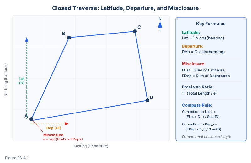
Bearings and Azimuths
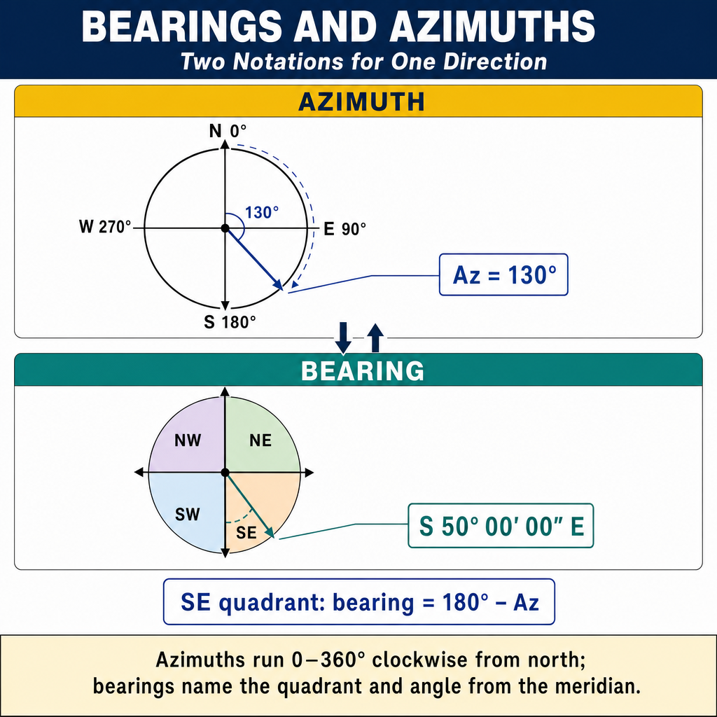
Bearing: Direction measured from north or south toward east or west, expressed in the quadrant system (e.g., N 45°00′ E). Range: 0 to 90 degrees in each quadrant.
Azimuth: Direction measured clockwise from north, from 0 to 360 degrees (e.g., 135°00′ = S 45°00′ E).
Conversions:
| Quadrant | Bearing | Azimuth |
|---|---|---|
| NE | N alpha E | alpha |
| SE | S alpha E | 180 - alpha |
| SW | S alpha W | 180 + alpha |
| NW | N alpha W | 360 - alpha |
Latitude and Departure
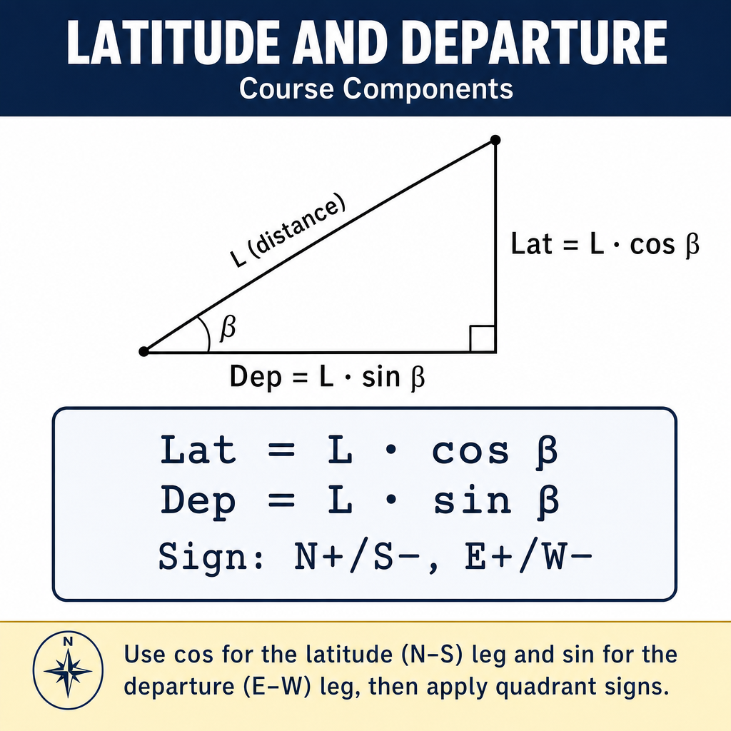
For each traverse course, latitude is the north-south component and departure is the east-west component:
Where D is the horizontal distance.
Sign conventions:
- North latitudes are positive; south latitudes are negative
- East departures are positive; west departures are negative
Traverse Computation
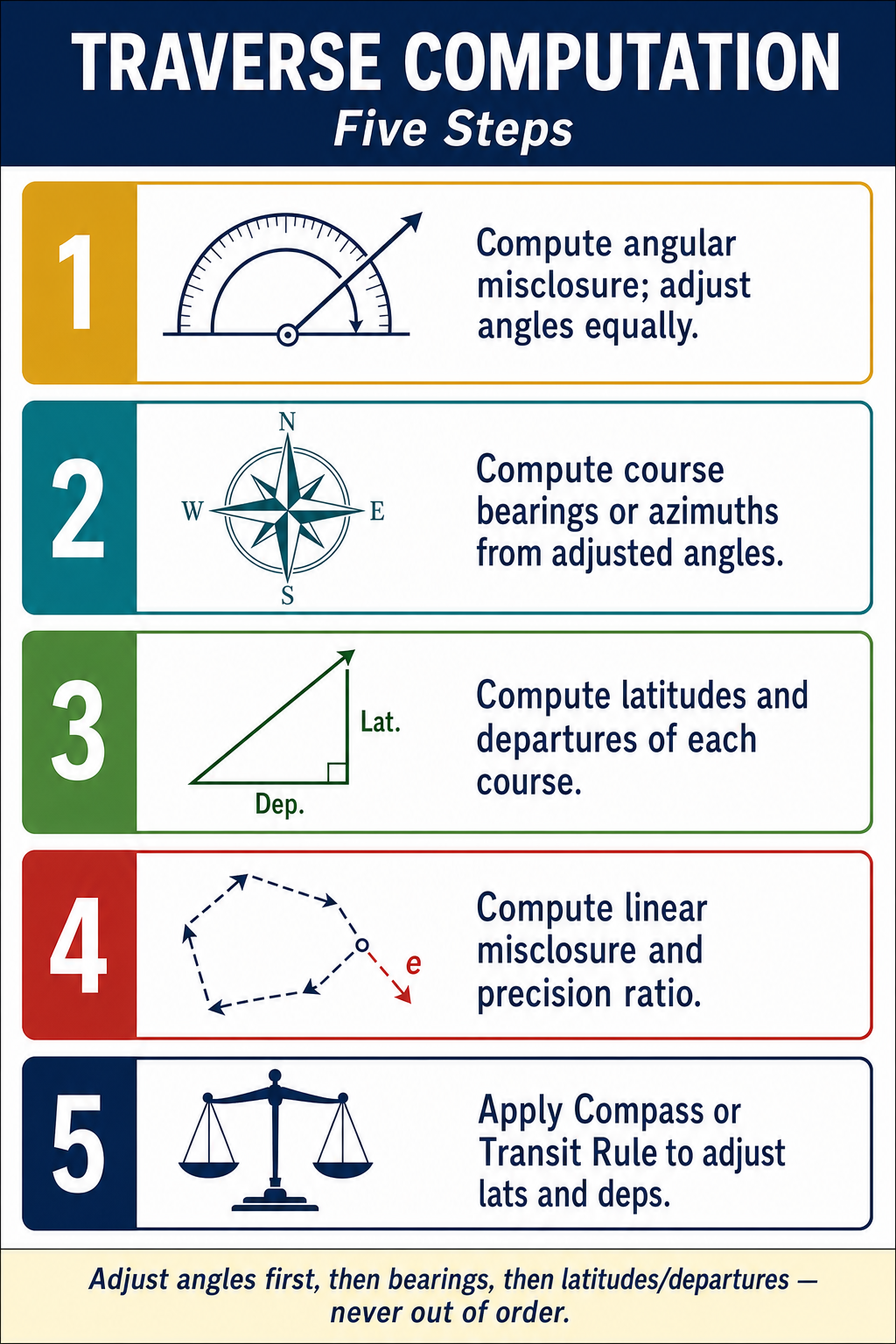
Step-by-step procedure:
- Balance angles: Distribute the angular misclosure equally among all angles (or weighted by judgment)
- Compute bearings/azimuths from the adjusted angles and the starting bearing
- Compute latitudes and departures for each course
- Sum latitudes and departures: In a closed traverse, the sums should be zero. Any non-zero sum is the misclosure
- Compute linear error of closure:
- Compute precision ratio:
- Adjust the traverse if the precision is acceptable
Compass Rule (Bowditch) Adjustment
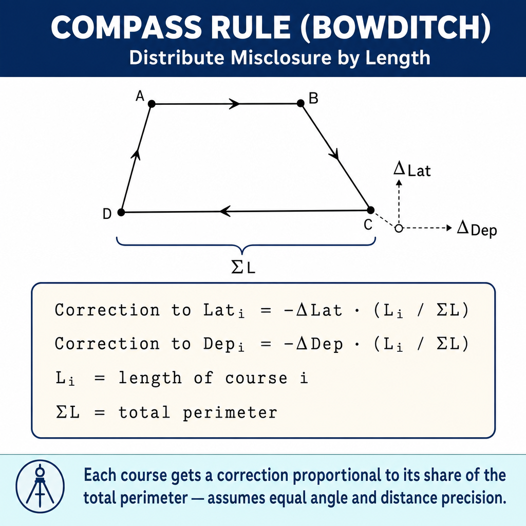
The Compass Rule distributes the misclosure proportionally to the length of each course:
Where Di is the length of course i and the summation of D is the total traverse length.
After adjustment: Adjusted Latitude = Original Latitude + Correction
Computing Coordinates
Starting from a known point, compute sequential coordinates:
Area Computation
Coordinate method (cross-multiply):
Where the subscript wraps around (point n+1 = point 1).
Example with 3 points:
Take the absolute value and divide by 2 to get the area.
Unit conversions for area:
- 1 acre = 43,560 sq ft
- 1 hectare = 10,000 sq m
- 1 acre = 0.4047 hectares
- 1 sq mile = 640 acres
COGO Operations
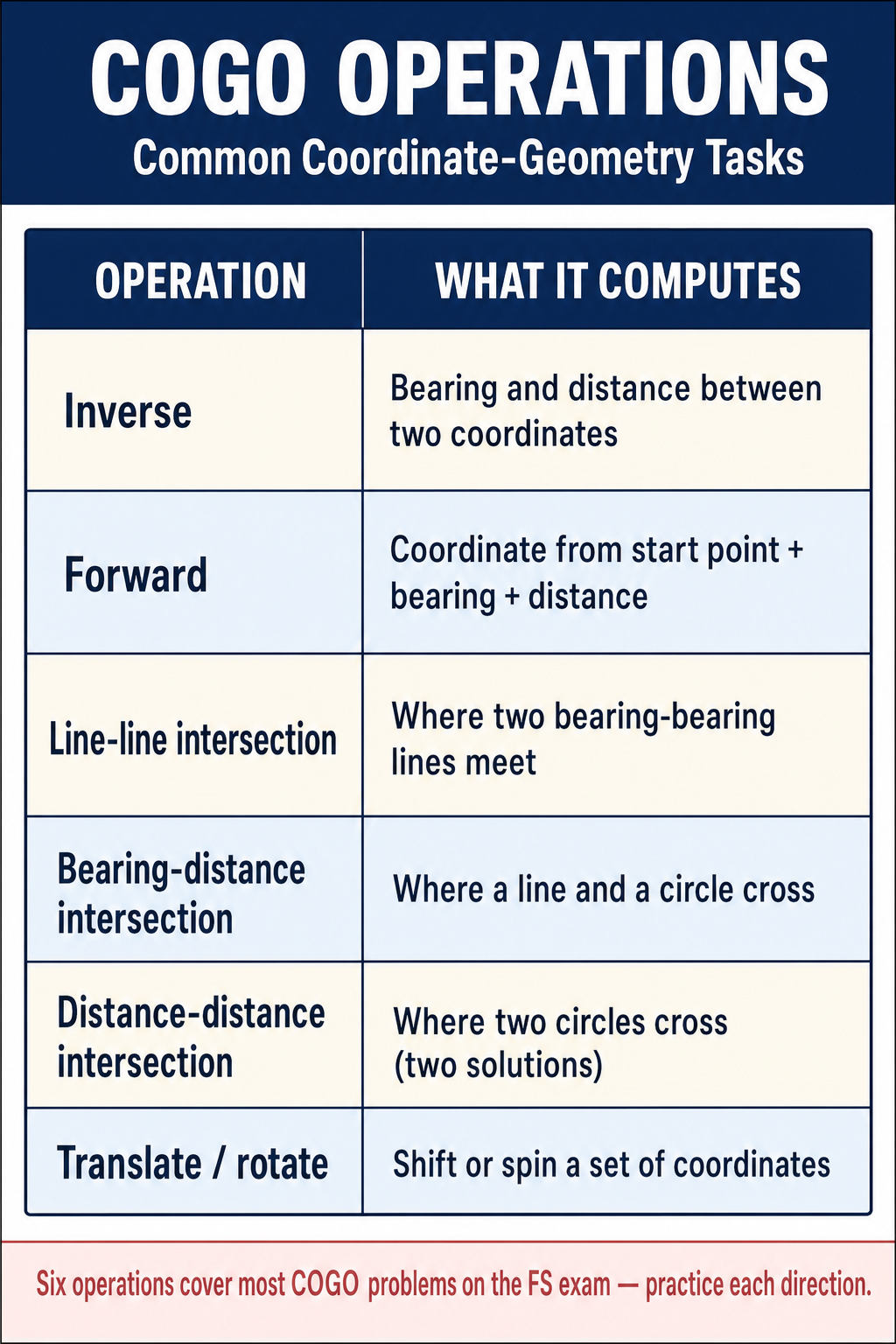
Inverse: Given coordinates of two points, compute the bearing and distance between them.
(Adjust the quadrant based on the signs of delta-N and delta-E.)
Intersection: Compute the coordinates of a point defined by the intersection of two lines (bearing-bearing intersection, bearing-distance intersection, or distance-distance intersection).
Resection: Determine the position of an unknown point by observing angles or distances to three or more known points.
Bearing-Bearing Intersection Example
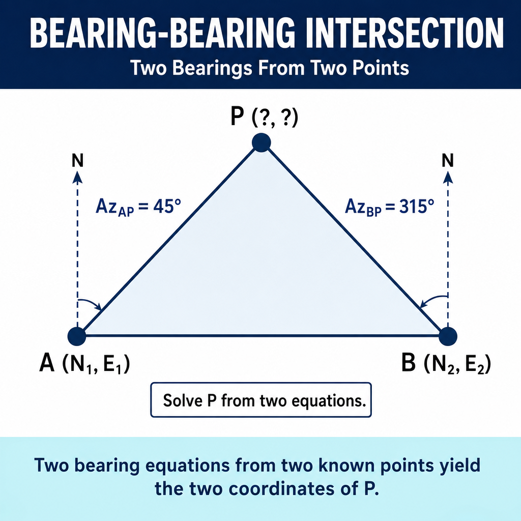
Given point A (1000, 1000) with bearing N 60°00′ E, and point B (1500, 1200) with bearing N 30°00′ W, find the intersection point:
- Set up parametric equations for each line
- Solve the simultaneous equations for the intersection coordinates
- This is a common FS exam problem type
Common wrong path — using the weak case of resection. A three-point resection determines the unknown position of an occupied point by observing angles to three known stations. The math is clean except when the three known stations and the occupied point all lie on (or near) a common circle — this is the "dangerous circle" or "weak case," where the intersection becomes mathematically indeterminate and small observation errors blow up into large position errors. Students sometimes pick three known stations without checking geometry, then get wildly inaccurate results without understanding why. Before committing to a resection, sketch the four points (three known + one unknown) and verify they do NOT fall near a common circle — the strongest geometry has the unknown point well inside the triangle formed by the three known points. Exam questions bait this by describing a resection scenario with poor geometry and asking why the results are unreliable; the answer is "proximity to the dangerous circle," not measurement error.
Quick retrieval check — try before reading on.
▶A surveyor needs to determine the coordinates of an unknown point P by resection. Three NGS monuments A, B, C are available within 2 km. The surveyor observes horizontal angles APB = 45°00' and BPC = 30°00' at point P. Why might this resection produce a position with 10× higher uncertainty than the observed angle precision would suggest?
The most likely cause is weak geometry — the four points (A, B, C, and P) are at or near a common circle. In resection, observed angles APB and BPC define two circular arcs through the known stations; the unknown point P lies on both arcs. When the geometry places P near the circumcircle of triangle ABC, small angle-observation errors translate into large uncertainties perpendicular to that circle — the solution becomes ill-conditioned. The solution: add a fourth control station (so the resection is over-determined and the dangerous-circle issue is diluted) or reposition the rover so the unknown point is clearly inside the triangle formed by A, B, C. Other possibilities include multipath, pointing error on an obscured target, or a blundered identification of one of the known monuments — but the geometric issue is the most common exam answer for "unexpectedly poor resection accuracy."
Exam Tips
- Latitude = D x cos(bearing); Departure = D x sin(bearing) -- memorize this
- The Compass Rule adjusts proportionally to course length -- longer courses get larger adjustments
- Precision ratio = linear error / total length -- express as 1:n (e.g., 1:20,000)
- The coordinate area method is the most reliable; practice it until it is second nature
- 1 acre = 43,560 sq ft -- you will need this conversion
- When computing azimuths from coordinates, be careful about the quadrant (arctan alone does not identify the quadrant)
- The FS exam will have multiple traverse and COGO problems; speed and accuracy are essential
- Practice converting between bearings and azimuths quickly
- Know how to compute the inverse (bearing and distance from coordinates) -- this appears frequently
- Remember: north latitudes and east departures are positive; south and west are negative
Related Test Topics
- Control Surveys and Standards (Module 1, Topic 1.5)
- Route Surveying and Alignments (Topic 4.3)
- State Plane Coordinates (Topic 4.6)
- Coordinate Transformations (Topic 4.8)
Further Reading
Authoritative sources for deeper study
Wolf & Ghilani, Elementary Surveying — An Introduction to Geomatics (13th Ed., 2012) — Comprehensive surveying text covering instruments, field procedures, and computations.
Allan, Principles of Geospatial Surveying (Ethernet Edu mirror) — Survey of geospatial principles, instruments, and adjustment.
FGDC Geospatial Positioning Accuracy Standards — National standard for positional accuracy reporting (NSSDA).
Last updated: 2026-04-17