FS Exam Preparation
Comprehensive preparation for the Fundamentals of Surveying (FS) exam. 7 modules covering all 7 exam domains with 60 in-depth topics.
Module 1: Surveying Processes & Methods
Module 2: Mapping Processes & Methods
Module 3: Boundary Law & Real Property
Module 4: Surveying Principles & Geodesy
Module 5: Survey Computations
Module 6: Business Concepts
Cadastral & Boundary Surveys
Learning Objectives
After completing this topic, you should be able to:
- Define cadastral and boundary surveys and their purposes
- Describe the steps in a retracement survey
- Explain the role of evidence in boundary determination
- Identify the types of boundary monuments and their significance
- Understand the difference between original and retracement surveys
- Describe the surveyor's role as a quasi-judicial officer
Overview
Cadastral surveys are surveys that establish, define, or reestablish property boundaries. The term "cadastral" comes from the word "cadastre," meaning a public register of property boundaries and ownership. In the United States, the term is often associated specifically with the Public Land Survey System (PLSS), but more broadly it encompasses all surveys related to land ownership boundaries.
Boundary surveys determine the location of property lines based on the interpretation of deeds, plats, monuments, and other evidence. The FS exam tests fundamental concepts of boundary surveying, while the PS exam delves much deeper into the legal reasoning involved.
Key Concepts
Original Survey vs. Retracement Survey
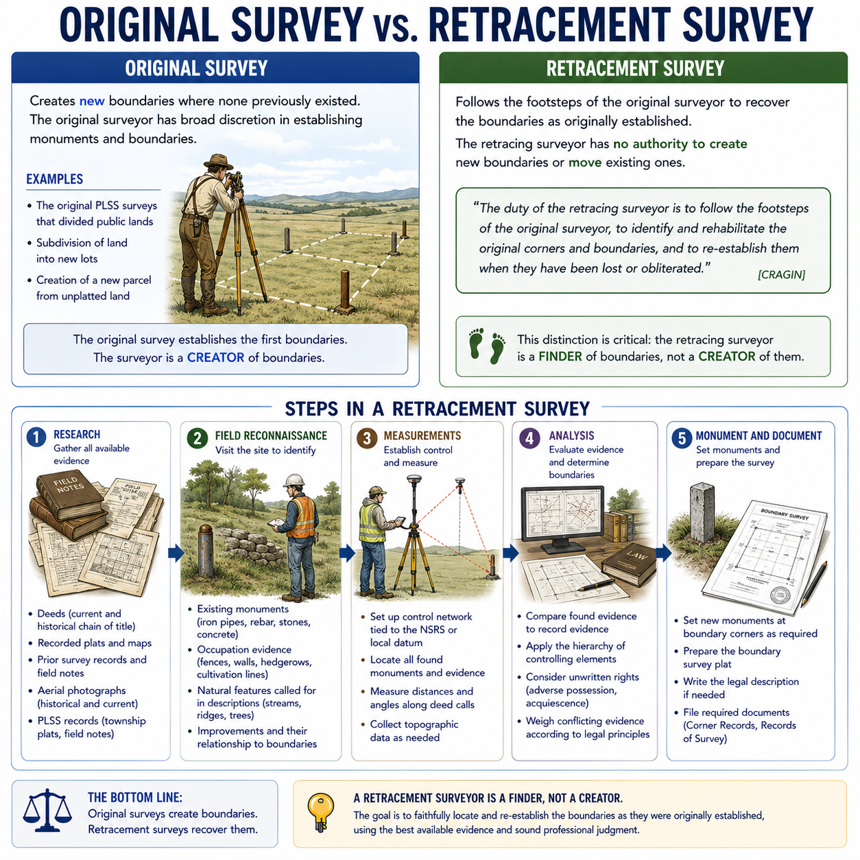
Original survey: Creates new boundaries where none previously existed. The original surveyor has broad discretion in establishing monuments and boundaries. Examples include:
- The original PLSS surveys that divided public lands
- Subdivision of land into new lots
- Creation of a new parcel from unplatted land
Retracement survey: Follows the footsteps of the original surveyor to recover the boundaries as originally established. The retracing surveyor has no authority to create new boundaries or move existing ones.
The duty of the retracing surveyor — articulated in a long line of cases (including Cragin v. Powell, 128 U.S. 691 (1888), on the inviolability of original corners) and codified in Brown's Boundary Control and Legal Principles — is to follow the footsteps of the original surveyor, identify and rehabilitate the original corners and boundaries, and re-establish them only when they have been lost or obliterated. The retracing surveyor is a finder of original boundaries, not a creator of new ones.
This distinction is critical: the retracing surveyor is a finder of boundaries, not a creator of them.
Steps in a Retracement Survey
-
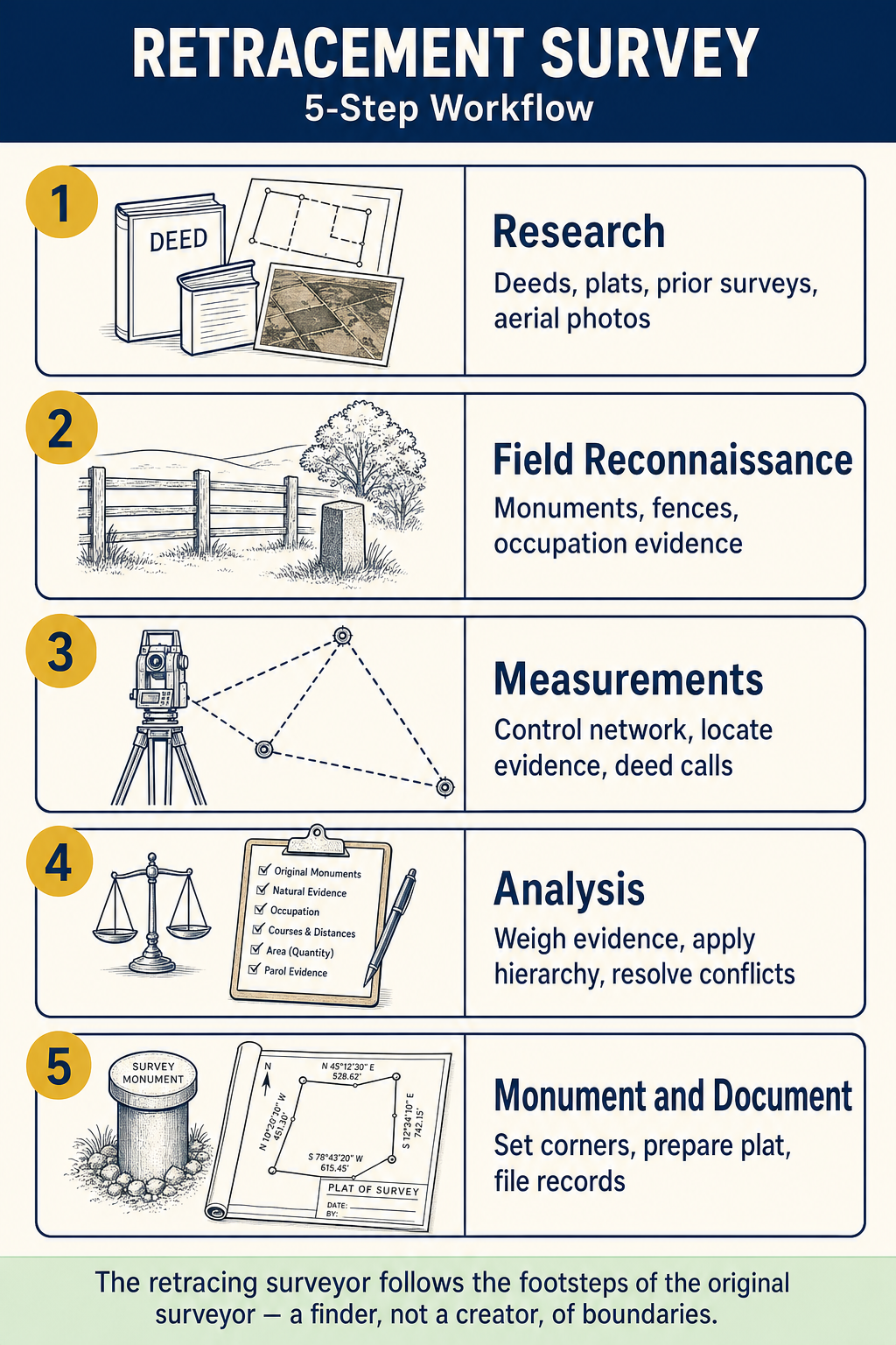
Research: Gather all available evidence
- Deeds (current and historical chain of title)
- Recorded plats and maps
- Prior survey records and field notes
- Aerial photographs (historical and current)
- PLSS records (township plats, field notes)
-
Field reconnaissance: Visit the site to identify
- Existing monuments (iron pipes, rebar, stones, concrete)
- Occupation evidence (fences, walls, hedgerows, cultivation lines)
- Natural features called for in descriptions (streams, ridges, trees)
- Improvements and their relationship to boundaries
-
Measurements: Establish control and measure
- Set up control network tied to the NSRS or local datum
- Locate all found monuments and evidence
- Measure distances and angles along deed calls
- Collect topographic data as needed
-
Analysis: Evaluate evidence and determine boundaries
- Compare found evidence to record evidence
- Apply the hierarchy of controlling elements
- Consider unwritten rights (adverse possession, acquiescence)
- Weigh conflicting evidence according to legal principles
-
Monument and document: Set monuments and prepare the survey
- Set new monuments at boundary corners as required
- Prepare the boundary survey plat
- Write the legal description if needed
- File required documents (Corner Records, Records of Survey)
Types of Boundary Evidence
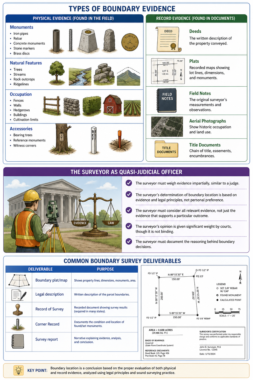
Physical evidence (found in the field):
- Monuments: Iron pipes, rebar, concrete monuments, stone markers, brass discs
- Natural features: Trees, streams, rock outcrops, ridgelines
- Occupation: Fences, walls, hedgerows, buildings, cultivation limits
- Accessories: Bearing trees, reference monuments, witness corners
Record evidence (found in documents):
- Deeds: The written description of the property conveyed
- Plats: Recorded maps showing lot lines, dimensions, and monuments
- Field notes: The original surveyor's measurements and observations
- Aerial photographs: Show historic occupation and land use
- Title documents: Chain of title, easements, encumbrances
The Surveyor as Quasi-Judicial Officer
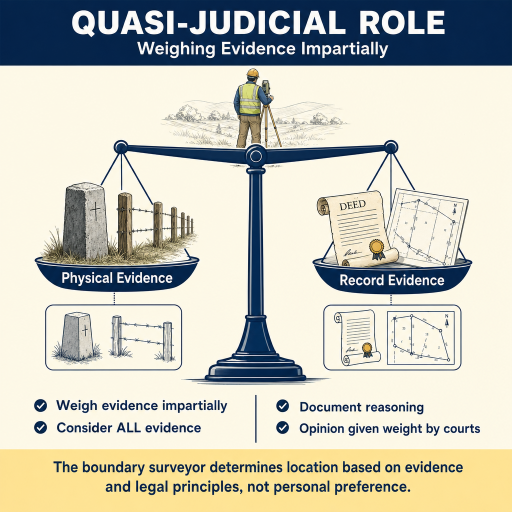
The boundary surveyor acts in a quasi-judicial capacity when determining boundary locations. This means:
- The surveyor must weigh evidence impartially, similar to a judge
- The surveyor's determination of boundary location is based on evidence and legal principles, not personal preference
- The surveyor must consider all relevant evidence, not just the evidence that supports a particular outcome
- The surveyor's opinion is given significant weight by courts, though it is not binding
- The surveyor must document the reasoning behind boundary decisions
Common Boundary Survey Deliverables
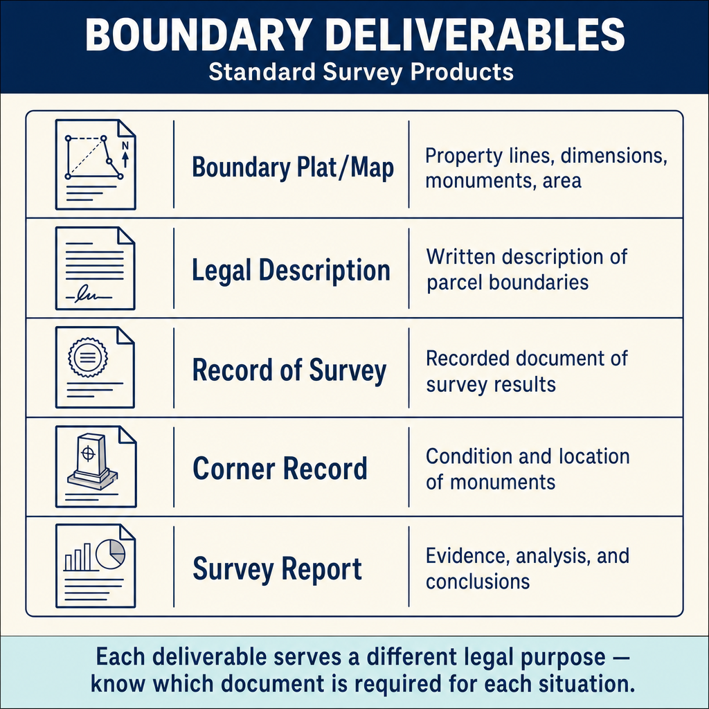
| Deliverable | Purpose |
|---|---|
| Boundary plat/map | Shows property lines, dimensions, monuments, area |
| Legal description | Written description of the parcel boundaries |
| Record of Survey | Recorded document showing survey results (required in many states) |
| Corner Record | Documents the condition and location of found/set monuments |
| Survey report | Narrative explaining evidence, analysis, and conclusions |
Common wrong path — mistaking a location survey for a boundary survey. A "mortgage survey" or "location survey" looks like a boundary survey — it shows the property outline, building locations, setbacks, and sometimes monuments — but it is NOT the same thing. Location surveys are typically performed without thorough boundary research and evidence analysis; they rely on existing monuments or fences without rigorously verifying them. Acceptable for a mortgage closing where the lender needs a sketch showing that the house is on the lot; NOT acceptable as a legal boundary determination. Clients occasionally ask for a "quick location" when what they need is a full boundary — and surveyors who deliver the quick product anyway, labeled incorrectly, expose themselves to liability. On the exam, a scenario that asks whether a location survey can substitute for a boundary survey: the answer is no. Certain products have specific scope limitations; mis-labeling them exposes the surveyor to exactly the liability that the location-survey disclaimer is supposed to prevent.
Quick retrieval check — try before reading on.
▶A real-estate agent asks you to provide a "simple location survey" for a property closing, saying the buyer "just needs something showing the house is on the lot." Your title-report review shows an easement dispute with a neighbor and evidence of occupation 4 ft inside the record boundary. Can you provide the "simple" location survey and label it appropriately?
Provide a full boundary survey — not a location survey. The known facts (easement dispute, occupation discrepancy) make this a boundary determination, not a simple location product. A location survey typically disclaims responsibility for boundary determination and does not involve the thorough records research or evidence analysis needed when real boundary issues exist. If you label the product a "location survey" while knowing it should be a boundary survey, you are either (a) delivering a boundary product under a label that disclaims the work, creating contractual and licensing problems, or (b) actually delivering a location product that fails to address the known boundary issues, creating client-harm liability when the dispute eventually surfaces. The correct response: explain to the agent that the property's circumstances require a full boundary survey, provide a fee estimate, and deliver that product. Do not deliver a cheaper product under a different label just because the agent wanted something fast — that shortcut is a professional-liability trap.
Boundary vs. Location Difference
- A boundary survey determines where the legal boundary is located based on evidence and legal principles
- A location survey (or mortgage/loan survey) shows the location of improvements relative to apparent boundaries, but typically does not make a determination of boundary location
- ALTA/NSPS surveys combine elements of both, with specific requirements for boundary evidence
Exam Tips
- A retracing surveyor follows the footsteps of the original surveyor -- never creates new boundaries
- The original survey controls; the retracement must recover what the original surveyor established
- Physical evidence (monuments found in the field) must be evaluated against record evidence (deeds, plats)
- The surveyor acts as a quasi-judicial officer when determining boundaries
- An open traverse is never acceptable for boundary survey control
- Know the basic steps of a retracement survey: research, reconnaissance, measurement, analysis, monumentation
- The FS exam tests fundamentals; the PS exam tests deeper legal analysis
- Corner Records and Records of Survey are important recording requirements in many jurisdictions
Related Test Topics
- Field Documentation (Topic 1.10)
- Controlling Elements and Evidence (Module 3, Topic 3.2)
- PLSS Fundamentals (Module 3, Topic 3.7)
- Metes and Bounds Descriptions (Module 3, Topic 3.6)
Further Reading
Authoritative sources for deeper study
Brown's Boundary Control and Legal Principles (7th Ed., Robillard & Wilson) — Standard textbook on boundary law, evidence hierarchy, and retracement.
Evidence and Procedures for Boundary Location (Robillard, Wilson, & Brown, 6th Ed., 2011) — Practical treatise on collecting, weighing, and applying boundary evidence.
BLM Manual of Surveying Instructions (2009) — Federal authority on PLSS surveys, corner restoration, and rectangular system.
2026 ALTA/NSPS Land Title Survey Standards — Current minimum standard detail requirements for ALTA/NSPS land title surveys (effective February 23, 2026).
Last updated: 2026-05-30